Bình Long night lights from space
Night Light of Bình Long (Bình Phước) from space (Vietnam) Src. Average luminocity for 10x10km area is 8.2338% and for 50x50km: 1.8581%.
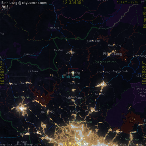
Analysis of Bình Long night lights 2016
Square area 10x10 km:
 0.22%
0.22%90-99
0.65%80-89
1.52%70-79
1.08%60-69
2.81%50-59
0.87%40-49
1.08%30-39
1.73%20-29
1.73%10-19
0%0-9
88.31%Square area 50x50 km:
0.03%90-99
0.04%80-89
0.26%70-79
0.39%60-69
0.28%50-59
0.24%40-49
0.53%30-39
0.48%20-29
0.46%10-19
0.33%0-9
96.96%Clear (daylight) street map image can be seen on geolist.org.
Map coordinates:
12° 20' 5.6" North, 105° 54' 9.9" East
11° 38' 49.6" North, 106° 36' 21.1" East
10° 57' 27.5" North, 107° 18' 32.4" East
Some cities around Bình Long sort by population:
• Ho Chi Minh City
91.7 km =57 mi,  178°
178°
• Biên Hòa
81.7 km =50.8 mi,  163°
163°
• Thủ Dầu Một
74.3 km =46.2 mi, 176°
• Củ Chi
75.9 km =47.2 mi,  189°
189°
• Phú Khương
65.5 km =40.7 mi,  231°
231°
• Tây Ninh
66.8 km =41.5 mi,  235°
235°
• Suong, KH
107.3 km =66.7 mi,  285°
285°
• Don Luan
32.7 km =20.3 mi,  112°
112°
1580349 (p: 15,000)
Sources (retrieved 2019-11-25):
» Earth at Night: Flat Maps 2012, 2016