Thủ Dầu Một night lights from space
Night Light of Thủ Dầu Một (Bình Dương) from space (Vietnam) Src. Average luminocity for 10x10km area is 85.6169% and for 50x50km: 65.0911%.
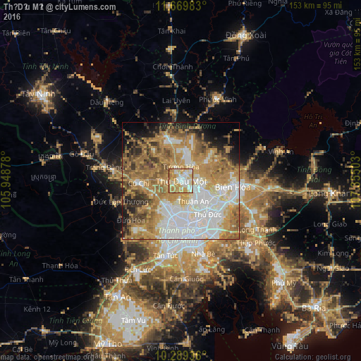
Analysis of Thủ Dầu Một night lights 2016
Square area 10x10 km:
 17.32%
90-99
24.68%80-89
21.43%70-79
26.84%60-69
9.09%50-59
0.65%40-49
0%30-39
0%20-29
0%10-19
0%0-9
0%Square area 50x50 km:
16.42%90-99
12.29%80-89
6.99%70-79
14.98%60-69
14.72%50-59
7.47%40-49
5.67%30-39
4.49%20-29
4.77%10-19
5.45%0-9
6.76%Clear (daylight) street map image can be seen on geolist.org.
Map coordinates:
11° 40' 11.4" North, 105° 56' 55.6" East
10° 58' 49.4" North, 106° 39' 6.8" East
10° 17' 21.7" North, 107° 21' 18.1" East
Some cities around Thủ Dầu Một sort by population:
• Ho Chi Minh City
17.7 km =11 mi,  187°
187°
• Biên Hòa
19.2 km =11.9 mi,  101°
101°
• Thị Xã Phú Mỹ
69.5 km =43.2 mi,  131°
131°
• Cần Giuộc
41.4 km =25.7 mi,  177°
177°
• Củ Chi
17.3 km =10.7 mi,  267°
267°
• Tân An
55.9 km =34.7 mi,  207°
207°
• Phú Khương
65.8 km =40.9 mi,  300°
300°
• Don Luan
66.6 km =41.4 mi,  22°
22°
1565022 (p: 91,009)
Sources (retrieved 2019-11-25):
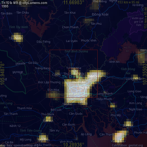
» NASA, Earths city lights 1995
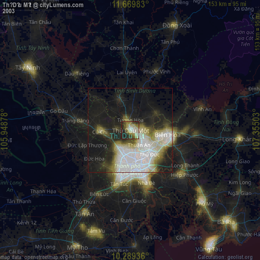
» NASA city lights 2003
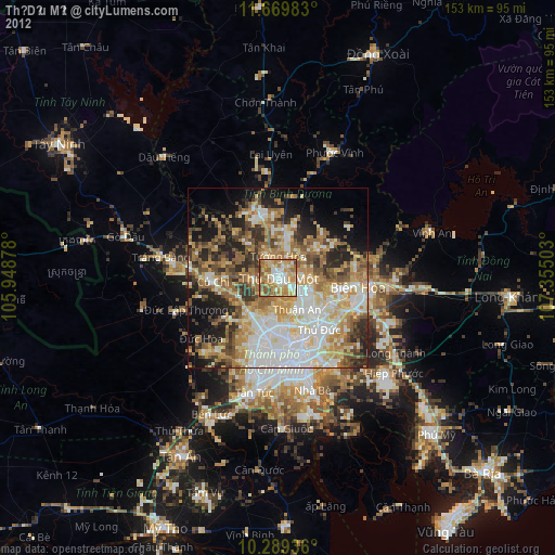
» Earth at Night: Flat Maps 2012, 2016