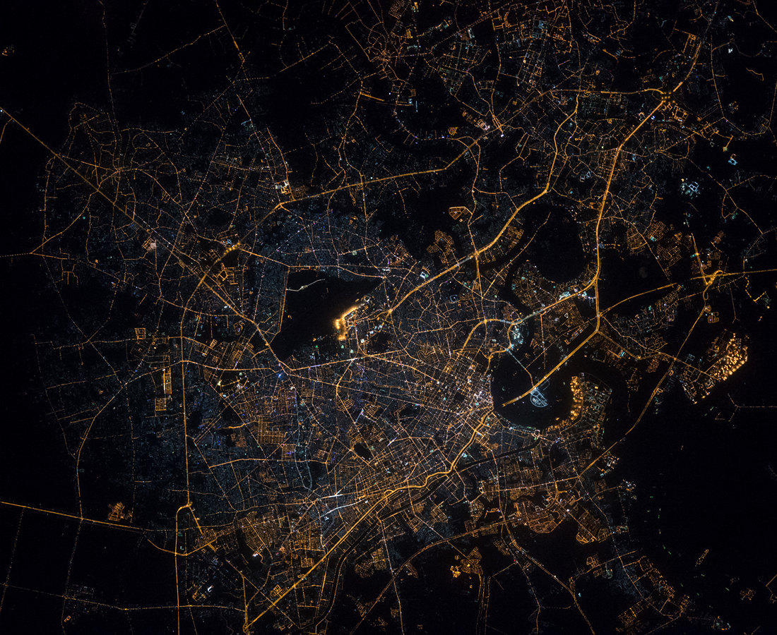
Ho Chi Minh City night lights from space
Night Light of Ho Chi Minh City (Ho Chi Minh) from space (Vietnam) Src. Average luminocity for 10x10km area is 99.5346% and for 50x50km: 71.3797%.
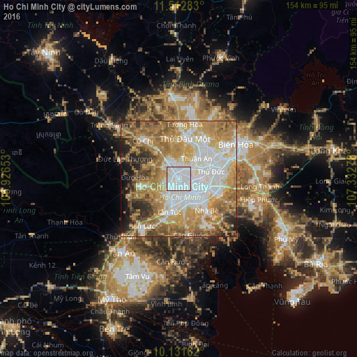
Analysis of Ho Chi Minh City night lights 2016
Square area 10x10 km:
 83.55%
90-99
15.58%80-89
0.87%70-79
0%60-69
0%50-59
0%40-49
0%30-39
0%20-29
0%10-19
0%0-9
0%Square area 50x50 km:
19.35%90-99
13.58%80-89
8.73%70-79
15.96%60-69
15.29%50-59
7.65%40-49
5.71%30-39
4.1%20-29
4.49%10-19
3.76%0-9
1.38%Clear (daylight) street map image can be seen on geolist.org.
Map coordinates:
11° 30' 46.2" North, 105° 55' 35.5" East
10° 49' 22.9" North, 106° 37' 46.7" East
10° 7' 53.8" North, 107° 19' 58" East
Fantastic image of Ho Chi Minh City from space taken by astronauts [src2], but I don't have information about it's orientation, scale or angle. If necessary, it was rotated manually, so North points approximately to upper direction. Click to zoom in:
Some cities around Ho Chi Minh City sort by population:
• Biên Hòa
25.2 km =15.7 mi,  57°
57°
• Thị Xã Phú Mỹ
61.6 km =38.3 mi,  117°
117°
• Cần Giuộc
24.3 km =15.1 mi,  169°
169°
• Mỹ Tho
59.3 km =36.8 mi,  209°
209°
• Thủ Dầu Một
17.7 km =11 mi,  7°
7°
• Củ Chi
22.4 km =13.9 mi,  318°
318°
• Tân An
39.7 km =24.7 mi,  216°
216°
• Cần Giờ
58 km =36 mi,  142°
142°
1566083 (p: 3,467,331)
Sources (retrieved 2019-11-25):
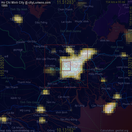
» NASA, Earths city lights 1995
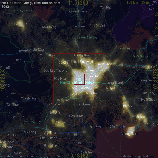
» NASA city lights 2003
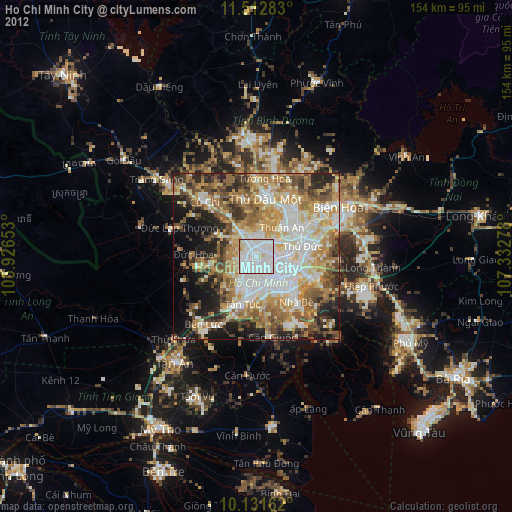
» Earth at Night: Flat Maps 2012, 2016
Src.2: NASA.gov ID: ISS046-E-199, 2015-12-12