Petare night lights from space
Night Light of Petare (Miranda) from space (Venezuela) Src. Average luminocity for 10x10km area is 82.2149% and for 50x50km: 30.8105%.
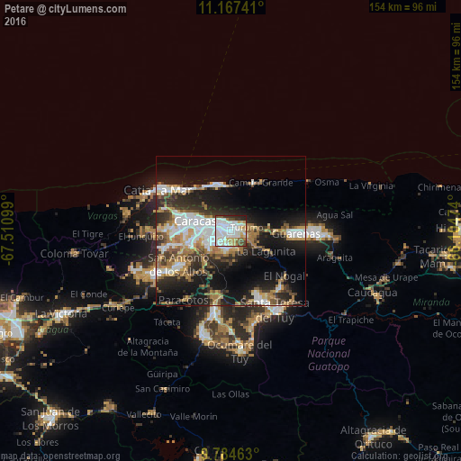
Analysis of Petare night lights 2016
Square area 10x10 km:
 38.02%
90-99
21.07%80-89
9.71%70-79
6.82%60-69
3.72%50-59
4.55%40-49
6.2%30-39
4.13%20-29
5.58%10-19
0.21%0-9
0%Square area 50x50 km:
6.83%90-99
5.27%80-89
2.69%70-79
3.75%60-69
6.03%50-59
2.52%40-49
3.3%30-39
5.26%20-29
8.44%10-19
16.08%0-9
39.84%Clear (daylight) street map image can be seen on geolist.org.
Map coordinates:
11° 10' 2.7" North, 67° 30' 39.6" West
10° 28' 36.4" North, 66° 48' 28.3" West
9° 47' 4.7" North, 66° 6' 17.1" West
Some cities around Petare sort by population:
• Caracas
7.9 km =4.9 mi,  279°
279°
• Baruta
8.8 km =5.5 mi,  237°
237°
• El Cafetal
2.7 km =1.7 mi, 241°
• Chacao
5.4 km =3.4 mi,  292°
292°
• Los Dos Caminos
3 km =1.9 mi,  309°
309°
• El Hatillo
6.2 km =3.9 mi,  198°
198°
• La Dolorita
2.7 km =1.7 mi,  61°
61°
• Caucagüito
7.7 km =4.8 mi,  81°
81°
3630297 (p: 364,684)
Sources (retrieved 2019-11-25):
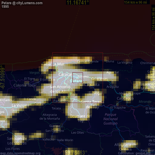
» NASA, Earths city lights 1995
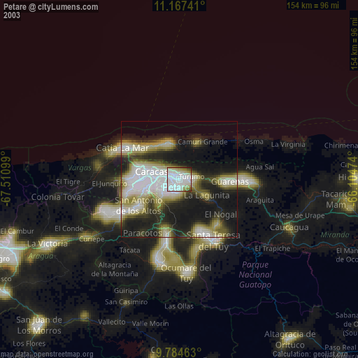
» NASA city lights 2003
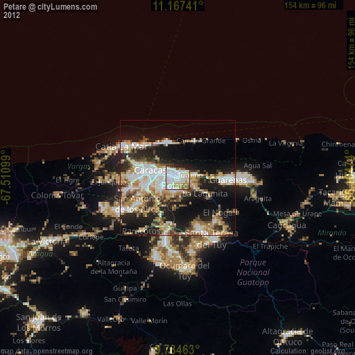
» Earth at Night: Flat Maps 2012, 2016