La Dolorita night lights from space
Night Light of La Dolorita (Miranda) from space (Venezuela) Src. Average luminocity for 10x10km area is 64.2645% and for 50x50km: 28.1681%.
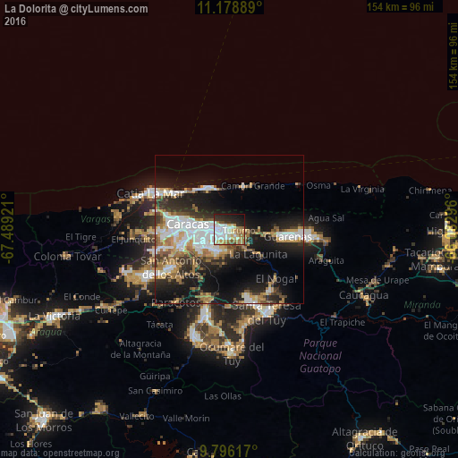
Analysis of La Dolorita night lights 2016
Square area 10x10 km:
 22.52%
90-99
11.36%80-89
7.64%70-79
7.44%60-69
13.84%50-59
3.93%40-49
2.27%30-39
4.34%20-29
15.29%10-19
9.92%0-9
1.45%Square area 50x50 km:
6.48%90-99
4.97%80-89
2.37%70-79
3.41%60-69
5.29%50-59
2.14%40-49
2.9%30-39
4.45%20-29
7.21%10-19
15.8%0-9
44.97%Clear (daylight) street map image can be seen on geolist.org.
Map coordinates:
11° 10' 44" North, 67° 29' 21.2" West
10° 29' 17.9" North, 66° 47' 9.9" West
9° 47' 46.2" North, 66° 4' 58.7" West
Some cities around La Dolorita sort by population:
• Caracas
10.2 km =6.3 mi,  269°
269°
• Petare
2.7 km =1.7 mi,  241°
241°
• Baruta
11.5 km =7.1 mi, 238°
• El Cafetal
5.4 km =3.4 mi, 241°
• Chacao
7.4 km =4.6 mi,  276°
276°
• Los Dos Caminos
4.7 km =2.9 mi, 277°
• El Hatillo
8.4 km =5.2 mi,  211°
211°
• Caucagüito
5.3 km =3.3 mi,  91°
91°
3803651 (p: 56,846)
Sources (retrieved 2019-11-25):
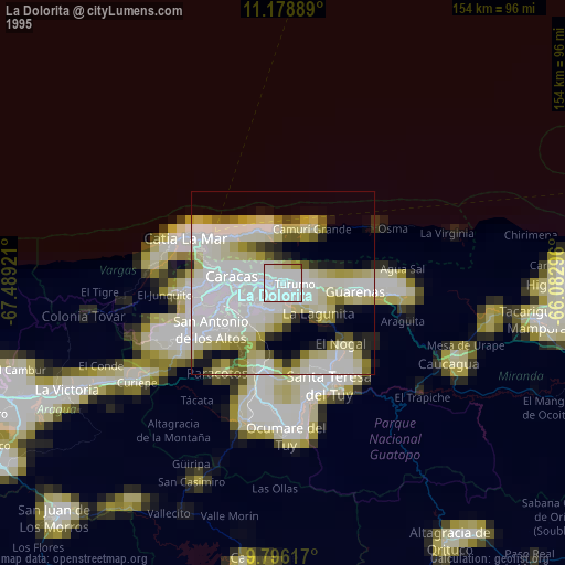
» NASA, Earths city lights 1995
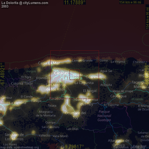
» NASA city lights 2003
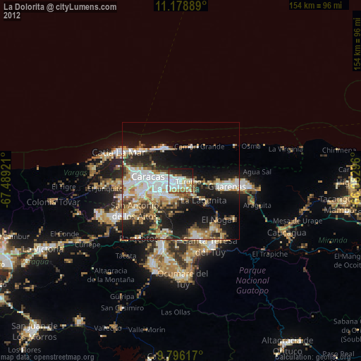
» Earth at Night: Flat Maps 2012, 2016