Oqtosh night lights from space
Night Light of Oqtosh (Samarqand) from space (Uzbekistan) Src. Average luminocity for 10x10km area is 9.1395% and for 50x50km: 1.9969%.
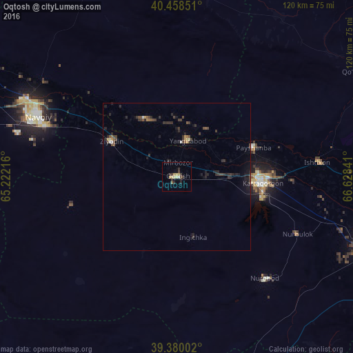
Analysis of Oqtosh night lights 2016
Square area 10x10 km:
 0.68%
0.68%90-99
0%80-89
2.55%70-79
1.87%60-69
0.68%50-59
0.34%40-49
0.68%30-39
4.93%20-29
1.7%10-19
0.85%0-9
85.71%Square area 50x50 km:
0.05%90-99
0.09%80-89
0.21%70-79
0.21%60-69
0.11%50-59
0.27%40-49
0.45%30-39
0.99%20-29
0.85%10-19
0.91%0-9
95.87%Clear (daylight) street map image can be seen on geolist.org.
Map coordinates:
40° 27' 30.6" North, 65° 13' 19.8" East
39° 55' 17" North, 65° 55' 31" East
39° 22' 48.1" North, 66° 37' 42.3" East
Some cities around Oqtosh sort by population:
• Navoiy
49.9 km =31 mi,  291°
291°
• Kattaqo‘rg‘on
28.3 km =17.6 mi,  95°
95°
• Nurota
73.9 km =45.9 mi,  344°
344°
• Yangirabot
12 km =7.5 mi,  14°
14°
• Payshanba
28.2 km =17.5 mi,  70°
70°
• Juma
67.1 km =41.7 mi,  109°
109°
• Charxin
76.2 km =47.3 mi, 109°
• Ishtixon
48.1 km =29.9 mi,  84°
84°
1217926 (p: 38,307)
Sources (retrieved 2019-11-25):
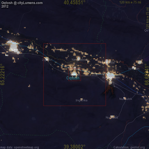
» Earth at Night: Flat Maps 2012, 2016