Payshanba night lights from space
Night Light of Payshanba (Samarqand) from space (Uzbekistan) Src. Average luminocity for 10x10km area is 8.5238% and for 50x50km: 3.4899%.
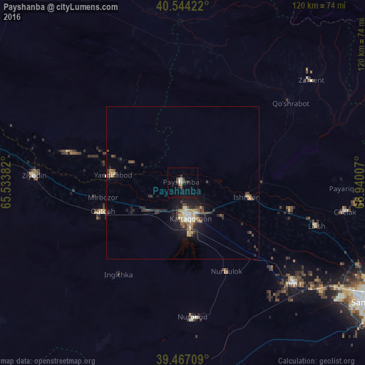
Analysis of Payshanba night lights 2016
Square area 10x10 km:
 0.51%
0.51%90-99
1.53%80-89
0%70-79
0.85%60-69
1.02%50-59
0.17%40-49
3.4%30-39
0.85%20-29
1.87%10-19
4.25%0-9
85.54%Square area 50x50 km:
0.17%90-99
0.48%80-89
0.34%70-79
0.59%60-69
0.34%50-59
0.45%40-49
0.61%30-39
0.96%20-29
1.01%10-19
2.56%0-9
92.47%Clear (daylight) street map image can be seen on geolist.org.
Map coordinates:
40° 32' 39.2" North, 65° 32' 1.8" East
40° 0' 28" North, 66° 14' 13" East
39° 28' 1.5" North, 66° 56' 24.3" East
Some cities around Payshanba sort by population:
• Kattaqo‘rg‘on
12.2 km =7.6 mi,  172°
172°
• Oqtosh
28.2 km =17.5 mi,  250°
250°
• Yangirabot
23.6 km =14.7 mi,  274°
274°
• Juma
48.8 km =30.3 mi,  131°
131°
• Chelak
54.1 km =33.6 mi,  100°
100°
• Charxin
57.1 km =35.5 mi, 127°
• Ishtixon
21.7 km =13.5 mi, 102°
• Daxbet
63.7 km =39.6 mi,  115°
115°
1513011 (p: 24,772)
Sources (retrieved 2019-11-25):
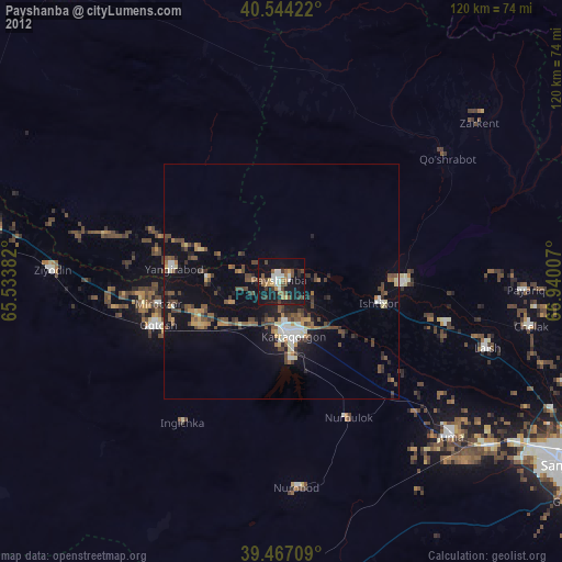
» Earth at Night: Flat Maps 2012, 2016