Salto night lights from space
Night Light of Salto from space (Uruguay) Src. Average luminocity for 10x10km area is 62.5822% and for 50x50km: 8.6432%.
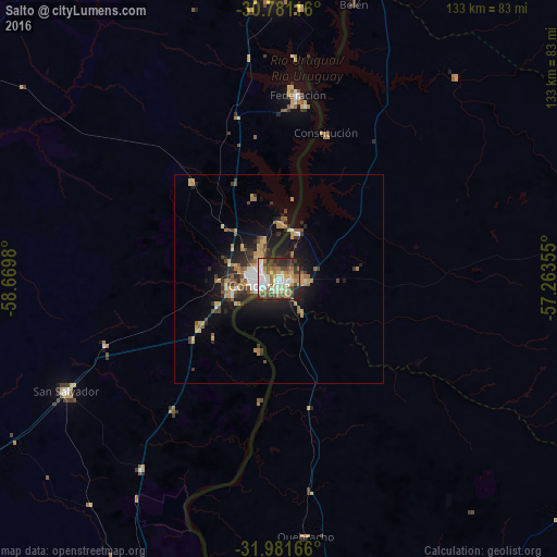
Analysis of Salto night lights 2016
Square area 10x10 km:
 11.01%
90-99
16.78%80-89
8.39%70-79
6.99%60-69
10.84%50-59
8.74%40-49
8.39%30-39
11.71%20-29
13.64%10-19
3.5%0-9
0%Square area 50x50 km:
0.82%90-99
1.13%80-89
1.1%70-79
1.39%60-69
1.45%50-59
1.17%40-49
1.23%30-39
1.65%20-29
2.64%10-19
5.46%0-9
81.97%Clear (daylight) street map image can be seen on geolist.org.
Map coordinates:
30° 46' 52.2" South, 58° 40' 11.3" West
31° 22' 60" South, 57° 58' 0" West
31° 58' 54" South, 57° 15' 48.8" West
Some cities around Salto sort by population:
• Concordia, AR
5.3 km =3.3 mi,  258°
258°
• Paysandú
104.4 km =64.9 mi,  185°
185°
• Chajarí, AR
70.4 km =43.7 mi,  358°
358°
• Federal, AR
91.1 km =56.6 mi,  301°
301°
• Federación, AR
42.4 km =26.3 mi,  8°
8°
• San Salvador, AR
57.7 km =35.9 mi,  242°
242°
• Villa Elisa, AR
95.9 km =59.6 mi,  205°
205°
• Mocoretá, AR
85 km =52.8 mi,  0°
0°
3440714 (p: 99,823)
Sources (retrieved 2019-11-25):
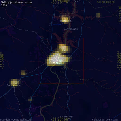
» NASA, Earths city lights 1995
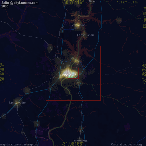
» NASA city lights 2003
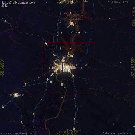
» Earth at Night: Flat Maps 2012, 2016