Nueva Helvecia night lights from space
Night Light of Nueva Helvecia (Colonia) from space (Uruguay) Src. Average luminocity for 10x10km area is 14.6886% and for 50x50km: 1.8095%.
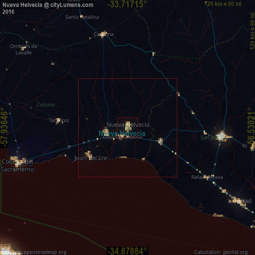
Analysis of Nueva Helvecia night lights 2016
Square area 10x10 km:
 0%
0%90-99
0%80-89
1.47%70-79
4.58%60-69
4.58%50-59
3.66%40-49
1.47%30-39
2.2%20-29
2.2%10-19
1.28%0-9
78.57%Square area 50x50 km:
0%90-99
0%80-89
0.22%70-79
0.39%60-69
0.49%50-59
0.58%40-49
0.19%30-39
0.47%20-29
0.26%10-19
0.14%0-9
97.25%Clear (daylight) street map image can be seen on geolist.org.
Map coordinates:
33° 43' 1.7" South, 57° 56' 11.3" West
34° 18' 0" South, 57° 13' 60" West
34° 52' 43.8" South, 56° 31' 48.8" West
Some cities around Nueva Helvecia sort by population:
• San José de Mayo
47.9 km =29.8 mi,  94°
94°
• Colonia del Sacramento
58.5 km =36.4 mi,  251°
251°
• Canelones
91.1 km =56.6 mi,  105°
105°
• Santa Lucía
79.2 km =49.2 mi,  102°
102°
• Juan L. Lacaze
24.1 km =15 mi,  236°
236°
• Libertad
67.6 km =42 mi,  123°
123°
• Rosario
10.9 km =6.8 mi,  260°
260°
• Tarariras
35.6 km =22.1 mi,  276°
276°
3441483 (p: 10,054)
Sources (retrieved 2019-11-25):
» Earth at Night: Flat Maps 2012, 2016