Yonkers night lights from space
Night Light of Yonkers (New York) from space (United States) Src. Average luminocity for 10x10km area is 86.0629% and for 50x50km: 77.2088%.
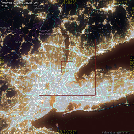
Analysis of Yonkers night lights 2016
Square area 10x10 km:
 36.9%
36.9%90-99
22.62%80-89
2.55%70-79
13.44%60-69
18.2%50-59
5.1%40-49
1.19%30-39
0%20-29
0%10-19
0%0-9
0%Square area 50x50 km:
32.35%90-99
16.73%80-89
7.26%70-79
8.98%60-69
12.45%50-59
5.84%40-49
3.49%30-39
3.9%20-29
4.54%10-19
3.49%0-9
0.99%Clear (daylight) street map image can be seen on geolist.org.
Map coordinates:
41° 27' 37" North, 74° 36' 6.8" West
40° 55' 52.4" North, 73° 53' 55.5" West
40° 23' 52.3" North, 73° 11' 44.3" West
Some cities around Yonkers sort by population:
• Mount Vernon
5.6 km =3.5 mi,  111°
111°
• Wakefield
5.4 km =3.4 mi,  133°
133°
• Tenafly
5.4 km =3.4 mi,  263°
263°
• Spuyten Duyvil
5.8 km =3.6 mi,  195°
195°
• Riverdale
3.5 km =2.2 mi,  190°
190°
• Cresskill
5.2 km =3.2 mi,  282°
282°
• Woodlawn
4.5 km =2.8 mi,  144°
144°
• Bronxville
5.7 km =3.5 mi,  82°
82°
5145215 (p: 201,116)
Sources (retrieved 2019-11-25):
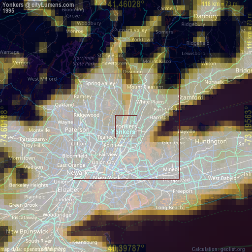
» NASA, Earths city lights 1995
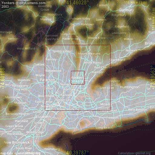
» NASA city lights 2003
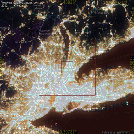
» Earth at Night: Flat Maps 2012, 2016