Woodway night lights from space
Night Light of Woodway (Texas) from space (United States) Src. Average luminocity for 10x10km area is 72.8864% and for 50x50km: 13.6596%.
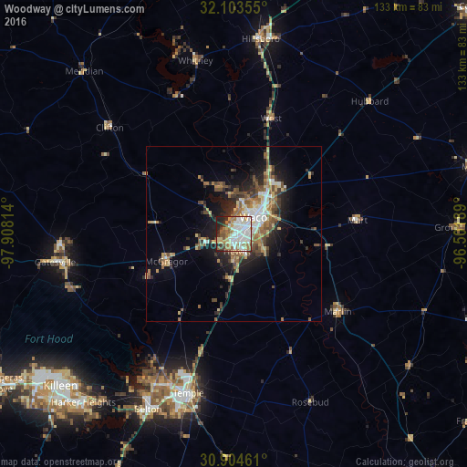
Analysis of Woodway night lights 2016
Square area 10x10 km:
 19.41%
90-99
24.13%80-89
6.64%70-79
6.82%60-69
13.29%50-59
8.74%40-49
4.2%30-39
3.5%20-29
9.97%10-19
3.32%0-9
0%Square area 50x50 km:
1.79%90-99
2.14%80-89
2.01%70-79
1.12%60-69
2.6%50-59
2.28%40-49
2.38%30-39
1.75%20-29
3.46%10-19
6.62%0-9
73.85%Clear (daylight) street map image can be seen on geolist.org.
Map coordinates:
32° 6' 12.8" North, 97° 54' 29.3" West
31° 30' 21.6" North, 97° 12' 18" West
30° 54' 16.6" North, 96° 30' 6.8" West
Some cities around Woodway sort by population:
• Waco
7.3 km =4.5 mi,  48°
48°
• Temple
47.2 km =29.3 mi,  196°
196°
• Hewitt
4.9 km =3 mi,  169°
169°
• Robinson
9.6 km =6 mi,  116°
116°
• Bellmead
13.4 km =8.3 mi,  42°
42°
• Lacy-Lakeview
16.8 km =10.4 mi, 35°
• Marlin
36.6 km =22.7 mi,  127°
127°
• McGregor
20.5 km =12.7 mi,  250°
250°
4743105 (p: 8,777)
Sources (retrieved 2019-11-25):
» Earth at Night: Flat Maps 2012, 2016