Marlin night lights from space
Night Light of Marlin (Texas) from space (United States) Src. Average luminocity for 10x10km area is 11.1451% and for 50x50km: 2.8251%.
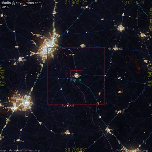
Analysis of Marlin night lights 2016
Square area 10x10 km:
 0.17%
0.17%90-99
0.52%80-89
2.27%70-79
1.4%60-69
3.5%50-59
2.1%40-49
0.87%30-39
3.67%20-29
1.22%10-19
0%0-9
84.27%Square area 50x50 km:
0.2%90-99
0.24%80-89
0.3%70-79
0.35%60-69
0.68%50-59
0.66%40-49
0.62%30-39
0.62%20-29
0.62%10-19
1.12%0-9
94.61%Clear (daylight) street map image can be seen on geolist.org.
Map coordinates:
31° 54' 18.4" North, 97° 36' 4.2" West
31° 18' 22.6" North, 96° 53' 52.9" West
30° 42' 13.1" North, 96° 11' 41.7" West
Some cities around Marlin sort by population:
• Waco
35.9 km =22.3 mi,  318°
318°
• Temple
48.2 km =30 mi,  241°
241°
• Hewitt
33.2 km =20.6 mi,  301°
301°
• Robinson
27.3 km =17 mi,  311°
311°
• Bellmead
37.7 km =23.4 mi,  327°
327°
• Woodway
36.6 km =22.7 mi, 307°
• Lacy-Lakeview
40.8 km =25.4 mi, 331°
• Center
50.3 km =31.3 mi,  63°
63°
4709215 (p: 5,682)
Sources (retrieved 2019-11-25):
» Earth at Night: Flat Maps 2012, 2016