Hewitt night lights from space
Night Light of Hewitt (Texas) from space (United States) Src. Average luminocity for 10x10km area is 55.9003% and for 50x50km: 13.3589%.
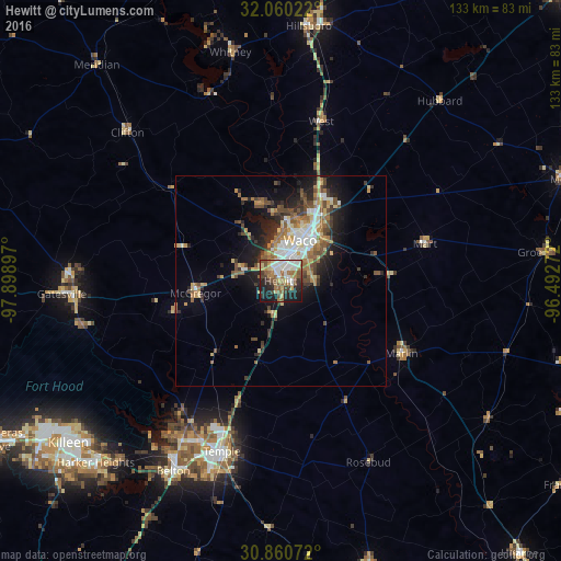
Analysis of Hewitt night lights 2016
Square area 10x10 km:
 10.31%
90-99
12.59%80-89
8.04%70-79
2.45%60-69
13.29%50-59
11.19%40-49
6.64%30-39
4.37%20-29
13.64%10-19
16.61%0-9
0.87%Square area 50x50 km:
1.79%90-99
2.14%80-89
1.95%70-79
1.08%60-69
2.51%50-59
2.17%40-49
2.36%30-39
1.78%20-29
3.42%10-19
6.47%0-9
74.33%Clear (daylight) street map image can be seen on geolist.org.
Map coordinates:
32° 3' 36.8" North, 97° 53' 56.3" West
31° 27' 44.6" North, 97° 11' 45" West
30° 51' 38.6" North, 96° 29' 33.8" West
Some cities around Hewitt sort by population:
• Waco
10.7 km =6.6 mi,  25°
25°
• Temple
42.8 km =26.6 mi,  199°
199°
• Robinson
7.7 km =4.8 mi,  85°
85°
• Bellmead
16.8 km =10.4 mi, 29°
• Woodway
4.9 km =3 mi,  349°
349°
• Lacy-Lakeview
20.6 km =12.8 mi, 25°
• Marlin
33.2 km =20.6 mi,  121°
121°
• McGregor
20.3 km =12.6 mi,  264°
264°
4697330 (p: 14,252)
Sources (retrieved 2019-11-25):
» Earth at Night: Flat Maps 2012, 2016