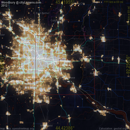
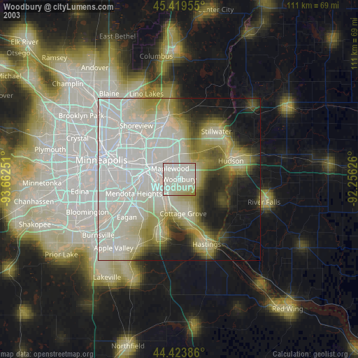
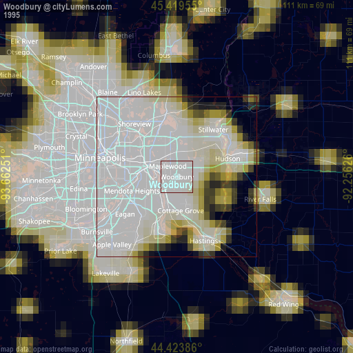
Woodbury night lights from space
Night Light of Woodbury (Minnesota) from space (United States) Src. Average luminocity for 10x10km area is 74.254% and for 50x50km: 43.4146%.

Analysis of Woodbury night lights 2016
Square area 10x10 km:
 17.46%
90-99
16.98%80-89
6.67%70-79
10.48%60-69
23.33%50-59
12.86%40-49
6.83%30-39
3.02%20-29
2.38%10-19
0%0-9
0%Square area 50x50 km:
11.58%90-99
9.34%80-89
4.26%70-79
5.64%60-69
8.47%50-59
5.39%40-49
4.42%30-39
2.88%20-29
5.45%10-19
11.15%0-9
31.43%Clear (daylight) street map image can be seen on geolist.org.
Map coordinates:
45° 25' 10.4" North, 93° 39' 45" West
44° 55' 25.9" North, 92° 57' 33.8" West
44° 25' 25.9" North, 92° 15' 22.5" West
Some cities around Woodbury sort by population:
• Maplewood
4.3 km =2.7 mi,  318°
318°
• Cottage Grove
10.8 km =6.7 mi,  173°
173°
• Inver Grove Heights
10.7 km =6.6 mi,  217°
217°
• Oakdale
4.4 km =2.7 mi,  354°
354°
• South Saint Paul
6.9 km =4.3 mi,  239°
239°
• North Saint Paul
10.2 km =6.3 mi, 345°
• Lake Elmo
10.2 km =6.3 mi,  38°
38°
• Saint Paul Park
9.4 km =5.8 mi,  195°
195°
5053358 (p: 67,855)
Sources (retrieved 2019-11-25):
» NASA, Earths city lights 1995
» NASA city lights 2003
» Earth at Night: Flat Maps 2012, 2016