Winchester night lights from space
Night Light of Winchester (Tennessee) from space (United States) Src. Average luminocity for 10x10km area is 38.5577% and for 50x50km: 6.0152%.
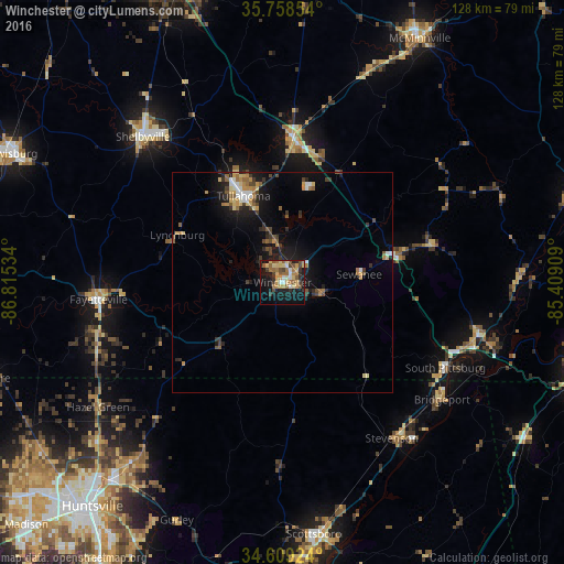
Analysis of Winchester night lights 2016
Square area 10x10 km:
 2.1%
2.1%90-99
3.85%80-89
11.89%70-79
4.37%60-69
7.34%50-59
7.69%40-49
5.07%30-39
5.77%20-29
4.37%10-19
29.55%0-9
18.01%Square area 50x50 km:
0.42%90-99
0.6%80-89
1.09%70-79
0.72%60-69
0.9%50-59
0.95%40-49
0.88%30-39
1.07%20-29
1.14%10-19
4.88%0-9
87.36%Clear (daylight) street map image can be seen on geolist.org.
Map coordinates:
35° 45' 30.7" North, 86° 48' 55.2" West
35° 11' 9.3" North, 86° 6' 44" West
34° 36' 33.3" North, 85° 24' 32.7" West
Some cities around Winchester sort by population:
• Shelbyville
45.7 km =28.4 mi,  316°
316°
• Tullahoma
21.5 km =13.4 mi,  335°
335°
• Scottsboro
57.5 km =35.7 mi,  172°
172°
• Manchester
33 km =20.5 mi,  3°
3°
• Fayetteville
41.8 km =26 mi,  264°
264°
• Lynchburg
26.1 km =16.2 mi,  294°
294°
• Meridianville
56 km =34.8 mi,  228°
228°
• Moores Mill
53 km =32.9 mi,  224°
224°
4668336 (p: 8,539)
Sources (retrieved 2019-11-25):
» Earth at Night: Flat Maps 2012, 2016