West Salem night lights from space
Night Light of West Salem (Wisconsin) from space (United States) Src. Average luminocity for 10x10km area is 11.3% and for 50x50km: 5.9202%.
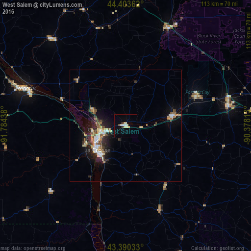
Analysis of West Salem night lights 2016
Square area 10x10 km:
 0.63%
0.63%90-99
1.9%80-89
4.44%70-79
0.63%60-69
0%50-59
0%40-49
1.75%30-39
0.16%20-29
1.27%10-19
0.16%0-9
89.05%Square area 50x50 km:
0.67%90-99
0.83%80-89
0.9%70-79
0.74%60-69
0.72%50-59
0.65%40-49
0.83%30-39
0.77%20-29
2.14%10-19
3.42%0-9
88.32%Clear (daylight) street map image can be seen on geolist.org.
Map coordinates:
44° 24' 13" North, 91° 47' 3.8" West
43° 53' 56.9" North, 91° 4' 52.5" West
43° 23' 25.2" North, 90° 22' 41.3" West
Some cities around West Salem sort by population:
• La Crosse
16.7 km =10.4 mi,  229°
229°
• North La Crosse
14.6 km =9.1 mi,  246°
246°
• Winona
47.7 km =29.6 mi,  290°
290°
• Onalaska
12.4 km =7.7 mi,  262°
262°
• Sparta
22.1 km =13.7 mi,  76°
76°
• Holmen
15.7 km =9.8 mi,  296°
296°
• Tomah
47.1 km =29.3 mi, 79°
• Richland Center
84 km =52.2 mi,  138°
138°
5278608 (p: 5,014)
Sources (retrieved 2019-11-25):
» Earth at Night: Flat Maps 2012, 2016