Holmen night lights from space
Night Light of Holmen (Wisconsin) from space (United States) Src. Average luminocity for 10x10km area is 11.1651% and for 50x50km: 5.268%.
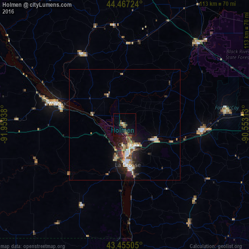
Analysis of Holmen night lights 2016
Square area 10x10 km:
 0.63%
0.63%90-99
0%80-89
1.27%70-79
0.95%60-69
2.22%50-59
1.9%40-49
2.7%30-39
2.38%20-29
3.49%10-19
12.06%0-9
72.38%Square area 50x50 km:
0.58%90-99
0.78%80-89
0.89%70-79
0.6%60-69
0.59%50-59
0.6%40-49
0.75%30-39
0.74%20-29
1.96%10-19
3.21%0-9
89.3%Clear (daylight) street map image can be seen on geolist.org.
Map coordinates:
44° 28' 2.1" North, 91° 57' 33.8" West
43° 57' 47.9" North, 91° 15' 22.5" West
43° 27' 18.2" North, 90° 33' 11.3" West
Some cities around Holmen sort by population:
• La Crosse
18.1 km =11.2 mi,  175°
175°
• North La Crosse
13 km =8.1 mi, 177°
• Winona
32.1 km =19.9 mi,  287°
287°
• Onalaska
8.9 km =5.5 mi,  169°
169°
• Sparta
35.6 km =22.1 mi,  93°
93°
• Tomah
60.2 km =37.4 mi, 88°
• Decorah
84.9 km =52.8 mi,  210°
210°
• West Salem
15.7 km =9.8 mi,  116°
116°
5256613 (p: 9,651)
Sources (retrieved 2019-11-25):
» Earth at Night: Flat Maps 2012, 2016