West Clarkston-Highland night lights from space
Night Light of West Clarkston-Highland (Washington) from space (United States) Src. Average luminocity for 10x10km area is 37.3214% and for 50x50km: 2.771%.
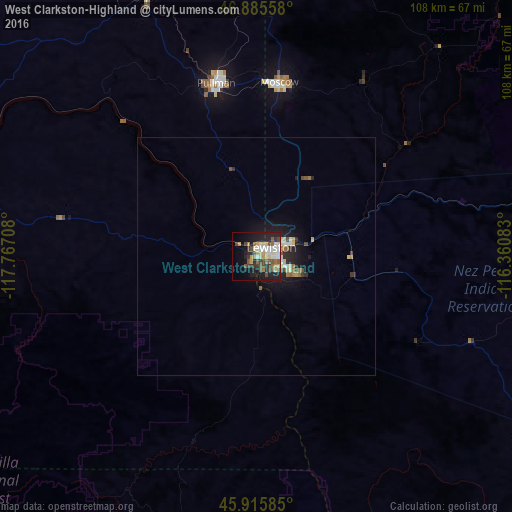
Analysis of West Clarkston-Highland night lights 2016
Square area 10x10 km:
 5.51%
5.51%90-99
7.29%80-89
5.51%70-79
3.72%60-69
4.61%50-59
5.95%40-49
7.14%30-39
5.06%20-29
12.5%10-19
16.96%0-9
25.74%Square area 50x50 km:
0.32%90-99
0.41%80-89
0.4%70-79
0.24%60-69
0.34%50-59
0.41%40-49
0.49%30-39
0.28%20-29
0.9%10-19
2.31%0-9
93.9%Clear (daylight) street map image can be seen on geolist.org.
Map coordinates:
46° 53' 8.1" North, 117° 46' 1.5" West
46° 24' 10.3" North, 117° 3' 50.2" West
45° 54' 57.1" North, 116° 21' 39" West
Some cities around West Clarkston-Highland sort by population:
• Pullman
37.6 km =23.4 mi,  346°
346°
• Lewiston
3.9 km =2.4 mi,  66°
66°
• Walla Walla
105.3 km =65.4 mi,  249°
249°
• Lewiston Orchards
7.2 km =4.5 mi,  110°
110°
• Moscow
37 km =23 mi,  7°
7°
• College Place
109.2 km =67.9 mi, 248°
• Clarkston
2.1 km =1.3 mi,  43°
43°
• Clarkston Heights-Vineland
2.3 km =1.4 mi,  220°
220°
7262495 (p: 5,261)
Sources (retrieved 2019-11-25):
» Earth at Night: Flat Maps 2012, 2016