Weirton night lights from space
Night Light of Weirton (West Virginia) from space (United States) Src. Average luminocity for 10x10km area is 50.5731% and for 50x50km: 12.0629%.
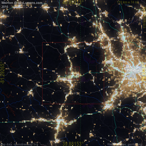
Analysis of Weirton night lights 2016
Square area 10x10 km:
 5.1%
5.1%90-99
10.2%80-89
9.01%70-79
6.63%60-69
5.95%50-59
9.01%40-49
6.63%30-39
13.78%20-29
18.37%10-19
14.46%0-9
0.85%Square area 50x50 km:
1.02%90-99
1.63%80-89
1.27%70-79
1.35%60-69
1.72%50-59
1.68%40-49
1.78%30-39
2.51%20-29
3.72%10-19
10.98%0-9
72.34%Clear (daylight) street map image can be seen on geolist.org.
Map coordinates:
40° 57' 7.7" North, 81° 17' 33.5" West
40° 25' 8.3" North, 80° 35' 22.3" West
39° 52' 53.5" North, 79° 53' 11" West
Some cities around Weirton sort by population:
• Steubenville
6.6 km =4.1 mi,  214°
214°
• Carnot-Moon
33.4 km =20.8 mi,  70°
70°
• East Liverpool
22.2 km =13.8 mi,  2°
2°
• Economy
36.8 km =22.9 mi,  56°
56°
• Aliquippa
38.2 km =23.7 mi,  50°
50°
• Ambridge
36.2 km =22.5 mi, 58°
• Martins Ferry
37.7 km =23.4 mi,  197°
197°
• Coraopolis
37.4 km =23.2 mi, 72°
5280814 (p: 19,175)
Sources (retrieved 2019-11-25):
» Earth at Night: Flat Maps 2012, 2016