Waupaca night lights from space
Night Light of Waupaca (Wisconsin) from space (United States) Src. Average luminocity for 10x10km area is 17.1397% and for 50x50km: 1.5301%.
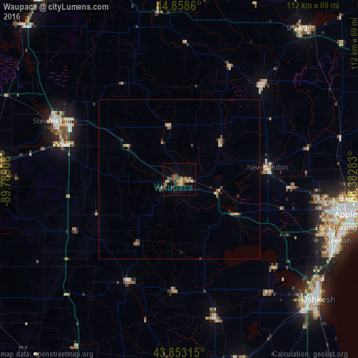
Analysis of Waupaca night lights 2016
Square area 10x10 km:
 0%
0%90-99
0.32%80-89
3.97%70-79
2.22%60-69
3.33%50-59
4.13%40-49
5.08%30-39
2.54%20-29
1.9%10-19
3.17%0-9
73.33%Square area 50x50 km:
0%90-99
0.01%80-89
0.45%70-79
0.23%60-69
0.26%50-59
0.29%40-49
0.29%30-39
0.24%20-29
0.41%10-19
0.18%0-9
97.64%Clear (daylight) street map image can be seen on geolist.org.
Map coordinates:
44° 51' 31" North, 89° 47' 20.7" West
44° 21' 28.9" North, 89° 5' 9.4" West
43° 51' 11.3" North, 88° 22' 58.2" West
Some cities around Waupaca sort by population:
• Appleton
54.4 km =33.8 mi,  101°
101°
• Oshkosh
57 km =35.4 mi,  130°
130°
• Stevens Point
42.9 km =26.7 mi,  295°
295°
• Neenah
53.2 km =33.1 mi,  111°
111°
• Menasha
53.8 km =33.4 mi, 108°
• Plover
38 km =23.6 mi,  286°
286°
• New London
27.8 km =17.3 mi,  82°
82°
• Berlin
44.8 km =27.8 mi,  165°
165°
5278083 (p: 6,014)
Sources (retrieved 2019-11-25):
» Earth at Night: Flat Maps 2012, 2016