Washington night lights from space
Night Light of Washington (Pennsylvania) from space (United States) Src. Average luminocity for 10x10km area is 55.2062% and for 50x50km: 18.2865%.
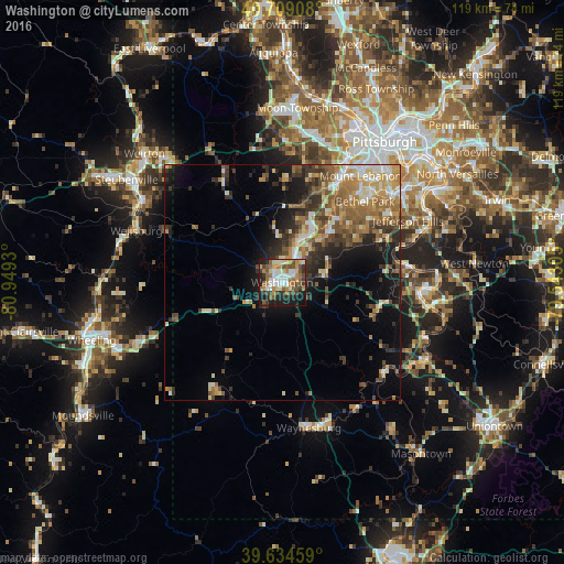
Analysis of Washington night lights 2016
Square area 10x10 km:
 10.55%
90-99
10.55%80-89
6.82%70-79
7.79%60-69
10.06%50-59
8.77%40-49
9.09%30-39
7.31%20-29
11.04%10-19
17.21%0-9
0.81%Square area 50x50 km:
1.85%90-99
2.97%80-89
1.97%70-79
2.73%60-69
3.53%50-59
3.4%40-49
3.03%30-39
3.3%20-29
4.47%10-19
7.65%0-9
65.12%Clear (daylight) street map image can be seen on geolist.org.
Map coordinates:
40° 42' 32.7" North, 80° 56' 57.5" West
40° 10' 26.3" North, 80° 14' 46.2" West
39° 38' 4.5" North, 79° 32' 35" West
Some cities around Washington sort by population:
• Mount Lebanon
26.2 km =16.3 mi,  39°
39°
• Bethel Park
24.5 km =15.2 mi,  45°
45°
• Upper Saint Clair
22.7 km =14.1 mi, 37°
• South Park Township
25.5 km =15.8 mi,  57°
57°
• Canonsburg
11 km =6.8 mi,  26°
26°
• Castle Shannon
28.5 km =17.7 mi, 41°
• Bridgeville
23.3 km =14.5 mi, 29°
• Bryn Mawr
19.8 km =12.3 mi, 43°
5218069 (p: 13,497)
Sources (retrieved 2019-11-25):
» Earth at Night: Flat Maps 2012, 2016