Warwick night lights from space
Night Light of Warwick (Rhode Island) from space (United States) Src. Average luminocity for 10x10km area is 63.276% and for 50x50km: 33.3388%.
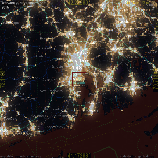
Analysis of Warwick night lights 2016
Square area 10x10 km:
 13.64%
90-99
12.82%80-89
9.74%70-79
11.53%60-69
9.42%50-59
9.25%40-49
5.52%30-39
10.71%20-29
7.79%10-19
7.95%0-9
1.62%Square area 50x50 km:
6.77%90-99
5.83%80-89
3.49%70-79
4.03%60-69
5.19%50-59
5.66%40-49
4.8%30-39
4.66%20-29
7.85%10-19
13.9%0-9
37.83%Clear (daylight) street map image can be seen on geolist.org.
Map coordinates:
42° 13' 22.5" North, 72° 7' 9.5" West
41° 42' 0.4" North, 71° 24' 58.2" West
41° 10' 22.7" North, 70° 42' 47" West
Some cities around Warwick sort by population:
• Cranston
9 km =5.6 mi,  348°
348°
• East Providence
13.2 km =8.2 mi,  16°
16°
• West Warwick
8.8 km =5.5 mi,  267°
267°
• Bristol
12.7 km =7.9 mi,  101°
101°
• Barrington
10 km =6.2 mi,  63°
63°
• Seekonk
13.7 km =8.5 mi,  28°
28°
• East Greenwich
5.5 km =3.4 mi,  216°
216°
• Warren
11.6 km =7.2 mi,  73°
73°
5225507 (p: 81,699)
Sources (retrieved 2019-11-25):
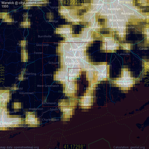
» NASA, Earths city lights 1995
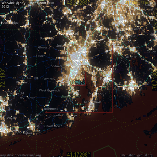
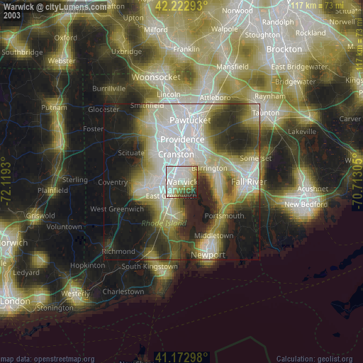
» NASA city lights 2003
» Earth at Night: Flat Maps 2012, 2016