Warsaw night lights from space
Night Light of Warsaw (Indiana) from space (United States) Src. Average luminocity for 10x10km area is 46.4789% and for 50x50km: 5.5914%.
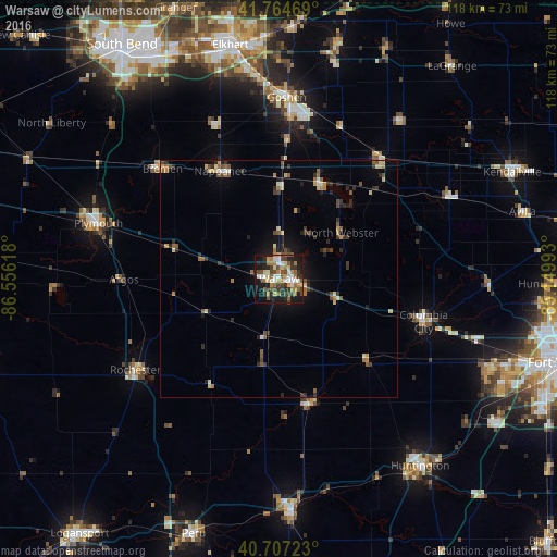
Analysis of Warsaw night lights 2016
Square area 10x10 km:
 5.03%
5.03%90-99
8.12%80-89
5.36%70-79
6.01%60-69
10.39%50-59
6.98%40-49
9.9%30-39
8.77%20-29
12.01%10-19
23.54%0-9
3.9%Square area 50x50 km:
0.28%90-99
0.59%80-89
0.79%70-79
0.68%60-69
0.89%50-59
0.92%40-49
1.09%30-39
0.92%20-29
1.74%10-19
2.68%0-9
89.42%Clear (daylight) street map image can be seen on geolist.org.
Map coordinates:
41° 45' 52.9" North, 86° 33' 22.2" West
41° 14' 17.2" North, 85° 51' 11" West
40° 42' 26" North, 85° 8' 59.7" West
Some cities around Warsaw sort by population:
• Goshen
38.3 km =23.8 mi,  2°
2°
• Wabash
49 km =30.4 mi,  176°
176°
• Plymouth
39.9 km =24.8 mi,  287°
287°
• Columbia City
31.8 km =19.8 mi,  106°
106°
• Nappanee
25.9 km =16.1 mi,  331°
331°
• Dunlap
44.8 km =27.8 mi,  352°
352°
• Rochester
36 km =22.4 mi,  237°
237°
• North Manchester
27.3 km =17 mi,  165°
165°
4927854 (p: 14,472)
Sources (retrieved 2019-11-25):
» Earth at Night: Flat Maps 2012, 2016