Waimea night lights from space
Night Light of Waimea (Hawaii) from space (United States) Src. Average luminocity for 10x10km area is 1.6548% and for 50x50km: 0.7531%.
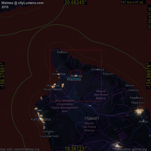
Analysis of Waimea night lights 2016
Square area 10x10 km:
 0%
0%90-99
0%80-89
0%70-79
0%60-69
0%50-59
0.79%40-49
1.59%30-39
0.79%20-29
0%10-19
0.79%0-9
96.03%Square area 50x50 km:
0%90-99
0%80-89
0.03%70-79
0.29%60-69
0.14%50-59
0.12%40-49
0.24%30-39
0.21%20-29
0.06%10-19
0.13%0-9
98.78%Clear (daylight) street map image can be seen on geolist.org.
Map coordinates:
20° 40' 56.8" North, 156° 22' 33.6" West
20° 1' 23.6" North, 155° 40' 22.4" West
19° 21' 40.4" North, 154° 58' 11.1" West
Some cities around Waimea sort by population:
• Hilo
69.1 km =42.9 mi,  118°
118°
• Kailua-Kona
54.6 km =33.9 mi,  218°
218°
• Hawaiian Paradise Park
87.4 km =54.3 mi, 123°
• Kalaoa
46 km =28.6 mi, 224°
• Hōlualoa
53.3 km =33.1 mi,  212°
212°
• Pukalani
113.9 km =70.8 mi,  322°
322°
• Kula
109.2 km =67.9 mi, 321°
• Wailea
109.2 km =67.9 mi,  312°
312°
5854571 (p: 9,212)
Sources (retrieved 2019-11-25):
» Earth at Night: Flat Maps 2012, 2016