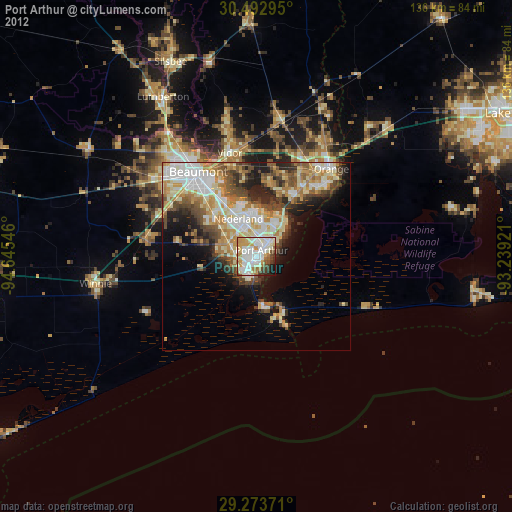
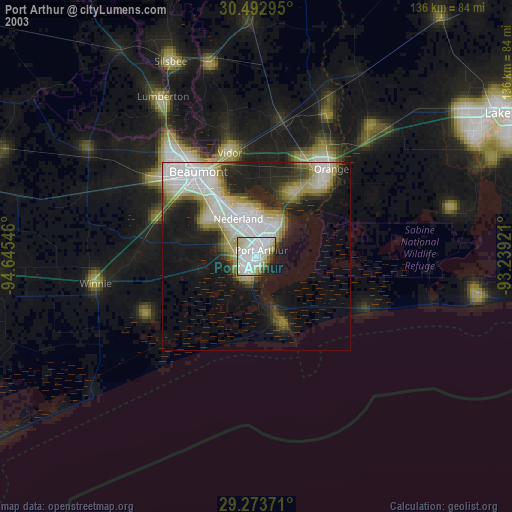
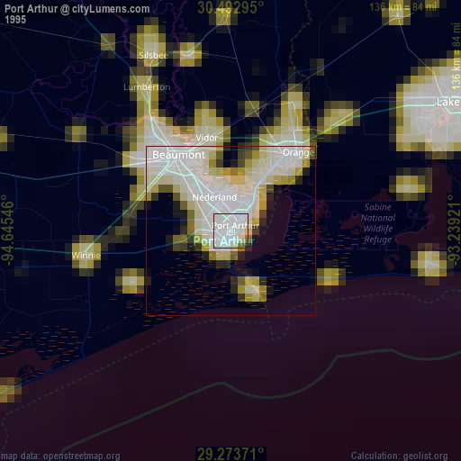
Port Arthur night lights from space
Night Light of Port Arthur (Texas) from space (United States) Src. Average luminocity for 10x10km area is 76.5357% and for 50x50km: 26.237%.
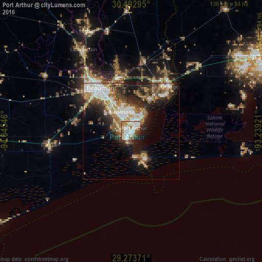
Analysis of Port Arthur night lights 2016
Square area 10x10 km:
 22.42%
90-99
26.19%80-89
9.13%70-79
6.94%60-69
9.13%50-59
6.94%40-49
5.36%30-39
5.16%20-29
4.96%10-19
3.77%0-9
0%Square area 50x50 km:
5.5%90-99
4.81%80-89
3.52%70-79
2.83%60-69
3.99%50-59
3.87%40-49
3.6%30-39
3.76%20-29
5.81%10-19
10.2%0-9
52.12%Clear (daylight) street map image can be seen on geolist.org.
Map coordinates:
30° 29' 34.6" North, 94° 38' 43.7" West
29° 53' 6.7" North, 93° 56' 32.4" West
29° 16' 25.4" North, 93° 14' 21.2" West
Some cities around Port Arthur sort by population:
• Beaumont
27.1 km =16.8 mi,  325°
325°
• Orange
30.4 km =18.9 mi,  40°
40°
• Nederland
11 km =6.8 mi, 334°
• Groves
7.4 km =4.6 mi,  19°
19°
• Lumberton
49 km =30.4 mi, 329°
• Vidor
28.3 km =17.6 mi,  345°
345°
• Bridge City
17.7 km =11 mi,  31°
31°
• Silsbee
56.3 km =35 mi,  336°
336°
4720039 (p: 55,340)
Sources (retrieved 2019-11-25):
» NASA, Earths city lights 1995
» NASA city lights 2003
» Earth at Night: Flat Maps 2012, 2016