Beaumont night lights from space
Night Light of Beaumont (Texas) from space (United States) Src. Average luminocity for 10x10km area is 86.5455% and for 50x50km: 30.33%.
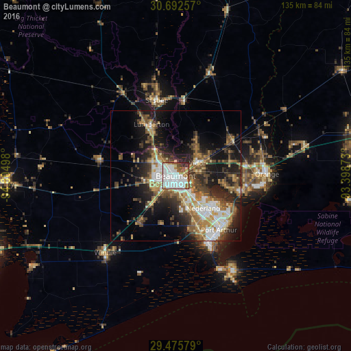

Analysis of Beaumont night lights 2016
Square area 10x10 km:
 43.18%
90-99
26.14%80-89
3.98%70-79
3.98%60-69
8.33%50-59
5.68%40-49
3.22%30-39
3.79%20-29
1.7%10-19
0%0-9
0%Square area 50x50 km:
5.32%90-99
4.93%80-89
3.67%70-79
3.19%60-69
4.72%50-59
5.19%40-49
5.05%30-39
5.2%20-29
8.28%10-19
13.64%0-9
40.8%Clear (daylight) street map image can be seen on geolist.org.
Map coordinates:
30° 41' 33.3" North, 94° 48' 17.9" West
30° 5' 9.8" North, 94° 6' 6.7" West
29° 28' 32.8" North, 93° 23' 55.4" West
Some cities around Beaumont sort by population:
• Port Arthur
27.1 km =16.8 mi,  145°
145°
• Nederland
16.3 km =10.1 mi,  139°
139°
• Groves
23.5 km =14.6 mi,  130°
130°
• Port Neches
17.4 km =10.8 mi, 127°
• Lumberton
22.1 km =13.7 mi,  334°
334°
• Vidor
9.7 km =6 mi,  58°
58°
• Bridge City
25.7 km =16 mi,  106°
106°
• Silsbee
30.1 km =18.7 mi,  345°
345°
4672989 (p: 118,129)
Sources (retrieved 2019-11-25):
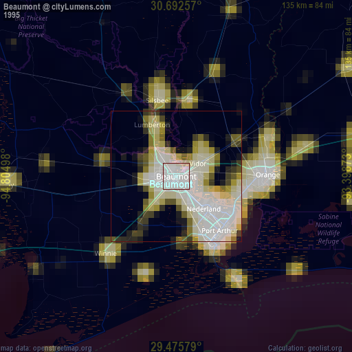
» NASA, Earths city lights 1995
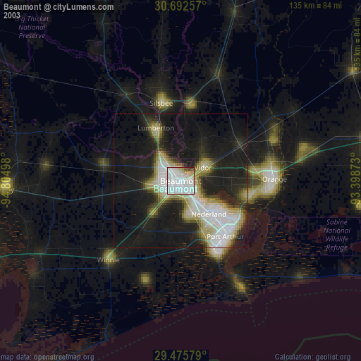
» NASA city lights 2003
» Earth at Night: Flat Maps 2012, 2016