Valley Center night lights from space
Night Light of Valley Center (California) from space (United States) Src. Average luminocity for 10x10km area is 10.3077% and for 50x50km: 20.6941%.
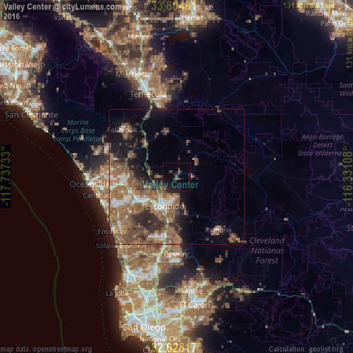
Analysis of Valley Center night lights 2016
Square area 10x10 km:
 0%
0%90-99
0%80-89
0%70-79
0%60-69
1.4%50-59
0.7%40-49
3.5%30-39
2.8%20-29
6.64%10-19
19.06%0-9
65.91%Square area 50x50 km:
2.06%90-99
2.06%80-89
0.81%70-79
1.58%60-69
7.39%50-59
6.34%40-49
4.99%30-39
3.87%20-29
4.58%10-19
7.22%0-9
59.1%Clear (daylight) street map image can be seen on geolist.org.
Map coordinates:
33° 48' 16.6" North, 117° 44' 14.4" West
33° 13' 6.1" North, 117° 2' 3.1" West
32° 37' 41.4" North, 116° 19' 51.9" West
Some cities around Valley Center sort by population:
• Escondido
12 km =7.5 mi,  203°
203°
• Vista
19.5 km =12.1 mi,  263°
263°
• San Marcos
14.8 km =9.2 mi,  235°
235°
• Rancho Penasquitos
29.8 km =18.5 mi,  194°
194°
• Poway
28.4 km =17.6 mi,  180°
180°
• Fallbrook
26.7 km =16.6 mi,  311°
311°
• Ramona
25 km =15.5 mi,  141°
141°
• Camp Pendleton North
28.3 km =17.6 mi,  292°
292°
5405430 (p: 9,277)
Sources (retrieved 2019-11-25):
» Earth at Night: Flat Maps 2012, 2016