Tulsa night lights from space
Night Light of Tulsa (Oklahoma) from space (United States) Src. Average luminocity for 10x10km area is 90.5916% and for 50x50km: 43.5431%.
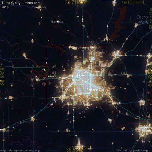
Analysis of Tulsa night lights 2016
Square area 10x10 km:
 45.6%
45.6%90-99
30.77%80-89
4.58%70-79
4.03%60-69
7.33%50-59
2.75%40-49
2.75%30-39
2.01%20-29
0.18%10-19
0%0-9
0%Square area 50x50 km:
8.46%90-99
8.89%80-89
6.45%70-79
5.24%60-69
7.51%50-59
7.78%40-49
5.77%30-39
6.45%20-29
6.08%10-19
8.41%0-9
28.96%Clear (daylight) street map image can be seen on geolist.org.
Map coordinates:
36° 43' 10.7" North, 96° 41' 45.2" West
36° 9' 14.3" North, 95° 59' 34" West
35° 35' 3.1" North, 95° 17' 22.7" West
Some cities around Tulsa sort by population:
• Broken Arrow
21.4 km =13.3 mi,  121°
121°
• Owasso
17.8 km =11.1 mi,  43°
43°
• Jenks
14.7 km =9.1 mi,  171°
171°
• Sapulpa
20.4 km =12.7 mi,  212°
212°
• Sand Springs
10.5 km =6.5 mi,  261°
261°
• Glenpool
22.1 km =13.7 mi,  183°
183°
• Skiatook
23.9 km =14.9 mi,  358°
358°
• Catoosa
22.5 km =14 mi,  80°
80°
4553433 (p: 403,505)
Sources (retrieved 2019-11-25):
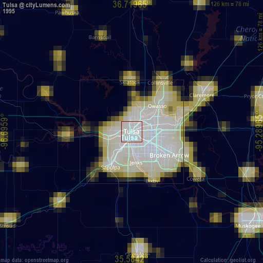
» NASA, Earths city lights 1995
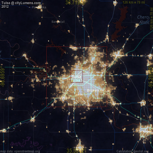
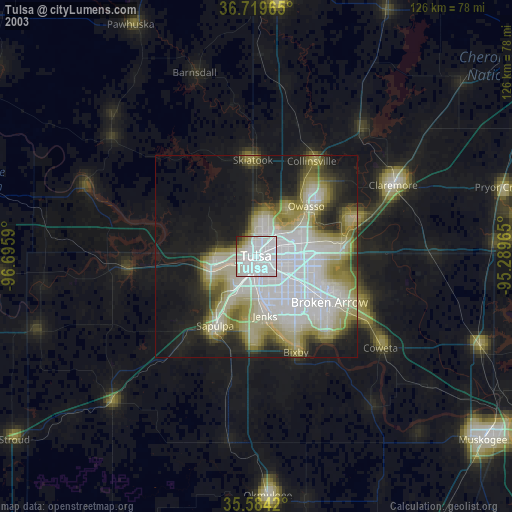
» NASA city lights 2003
» Earth at Night: Flat Maps 2012, 2016