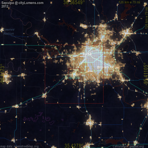
Sapulpa night lights from space
Night Light of Sapulpa (Oklahoma) from space (United States) Src. Average luminocity for 10x10km area is 49.1447% and for 50x50km: 29.5251%.
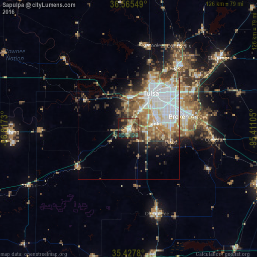
Analysis of Sapulpa night lights 2016
Square area 10x10 km:
 3.3%
3.3%90-99
5.49%80-89
7.88%70-79
8.42%60-69
8.79%50-59
11.17%40-49
13%30-39
12.82%20-29
13.92%10-19
15.2%0-9
0%Square area 50x50 km:
7.08%90-99
7.11%80-89
3.86%70-79
3.36%60-69
4.39%50-59
3.61%40-49
3.13%30-39
3.63%20-29
3.49%10-19
5.54%0-9
54.79%Clear (daylight) street map image can be seen on geolist.org.
Map coordinates:
36° 33' 55.8" North, 96° 49' 2.3" West
35° 59' 55.3" North, 96° 6' 51" West
35° 25' 40.1" North, 95° 24' 39.8" West
Some cities around Sapulpa sort by population:
• Tulsa
20.4 km =12.7 mi,  32°
32°
• Broken Arrow
29.7 km =18.5 mi,  78°
78°
• Owasso
38.1 km =23.7 mi,  37°
37°
• Bixby
21.7 km =13.5 mi,  106°
106°
• Jenks
13.4 km =8.3 mi, 78°
• Sand Springs
15.7 km =9.8 mi,  1°
1°
• Glenpool
10.6 km =6.6 mi,  116°
116°
• Catoosa
39.3 km =24.4 mi,  57°
57°
4550881 (p: 20,579)
Sources (retrieved 2019-11-25):
» Earth at Night: Flat Maps 2012, 2016