Broken Arrow night lights from space
Night Light of Broken Arrow (Oklahoma) from space (United States) Src. Average luminocity for 10x10km area is 84.8755% and for 50x50km: 39.6679%.
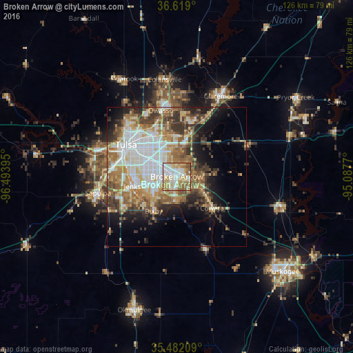
Analysis of Broken Arrow night lights 2016
Square area 10x10 km:
 21.43%
90-99
24.73%80-89
20.33%70-79
13.37%60-69
12.27%50-59
7.69%40-49
0.18%30-39
0%20-29
0%10-19
0%0-9
0%Square area 50x50 km:
8.15%90-99
8.47%80-89
5.88%70-79
4.85%60-69
6.58%50-59
6.25%40-49
4.14%30-39
6.13%20-29
5.09%10-19
8.26%0-9
36.2%Clear (daylight) street map image can be seen on geolist.org.
Map coordinates:
36° 37' 8.4" North, 96° 29' 38.2" West
36° 3' 9.4" North, 95° 47' 27" West
35° 28' 55.5" North, 95° 5' 15.7" West
Some cities around Broken Arrow sort by population:
• Tulsa
21.4 km =13.3 mi,  301°
301°
• Owasso
24.8 km =15.4 mi,  346°
346°
• Bixby
14.8 km =9.2 mi,  214°
214°
• Jenks
16.3 km =10.1 mi,  258°
258°
• Sapulpa
29.7 km =18.5 mi, 258°
• Glenpool
22.4 km =13.9 mi,  241°
241°
• Coweta
16.9 km =10.5 mi,  131°
131°
• Catoosa
15.7 km =9.8 mi,  14°
14°
4531405 (p: 106,563)
Sources (retrieved 2019-11-25):
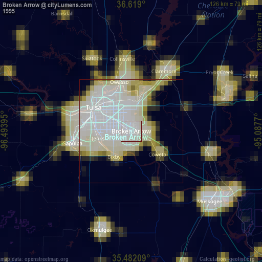
» NASA, Earths city lights 1995
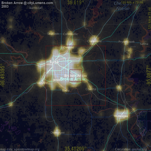
» NASA city lights 2003
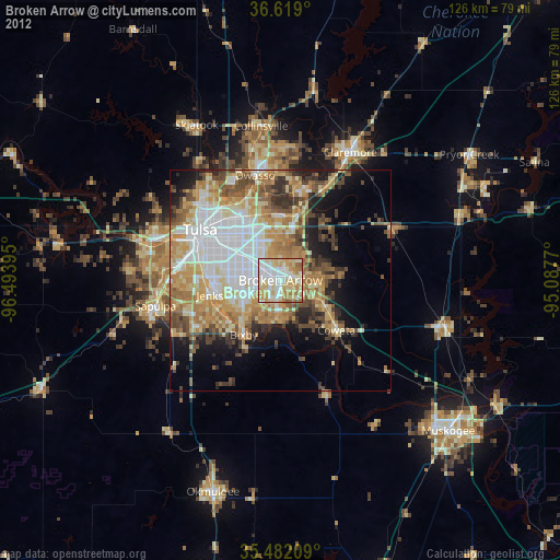
» Earth at Night: Flat Maps 2012, 2016