Temecula night lights from space
Night Light of Temecula (California) from space (United States) Src. Average luminocity for 10x10km area is 58.1758% and for 50x50km: 18.6572%.
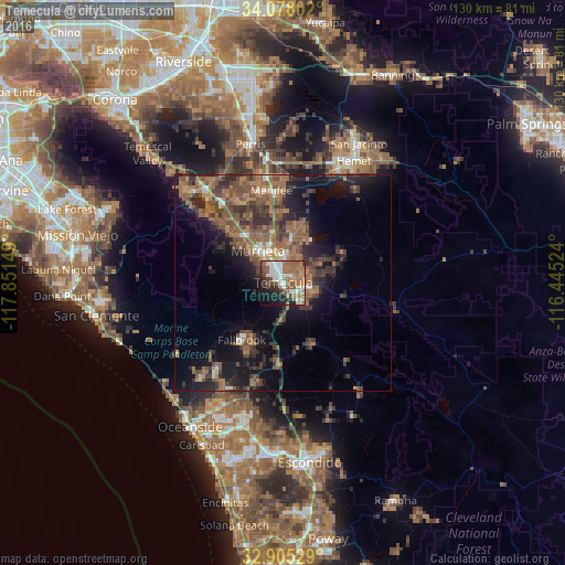
Analysis of Temecula night lights 2016
Square area 10x10 km:
 10.62%
90-99
13.92%80-89
1.47%70-79
5.86%60-69
16.3%50-59
15.93%40-49
8.42%30-39
3.66%20-29
10.81%10-19
10.99%0-9
2.01%Square area 50x50 km:
1.09%90-99
1.47%80-89
0.62%70-79
1.55%60-69
6.04%50-59
5.41%40-49
5.17%30-39
4.44%20-29
5.19%10-19
11.47%0-9
57.56%Clear (daylight) street map image can be seen on geolist.org.
Map coordinates:
34° 4' 40.9" North, 117° 51' 5.4" West
33° 29' 37.1" North, 117° 8' 54.1" West
32° 54' 19" North, 116° 26' 42.9" West
Some cities around Temecula sort by population:
• Murrieta
9 km =5.6 mi,  317°
317°
• Lake Elsinore
25.5 km =15.8 mi, 319°
• Wildomar
16.9 km =10.5 mi,  313°
313°
• Fallbrook
16.2 km =10.1 mi,  216°
216°
• Sun City
24.4 km =15.2 mi,  349°
349°
• Lakeland Village
24.3 km =15.1 mi, 311°
• Canyon Lake
24.2 km =15 mi,  331°
331°
• Camp Pendleton North
25.3 km =15.7 mi, 218°
5401395 (p: 112,011)
Sources (retrieved 2019-11-25):
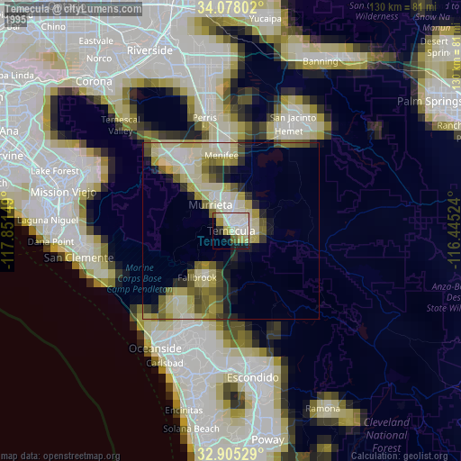
» NASA, Earths city lights 1995
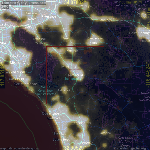
» NASA city lights 2003
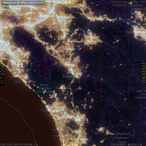
» Earth at Night: Flat Maps 2012, 2016