Taylor Mill night lights from space
Night Light of Taylor Mill (Kentucky) from space (United States) Src. Average luminocity for 10x10km area is 61.9383% and for 50x50km: 44.2101%.
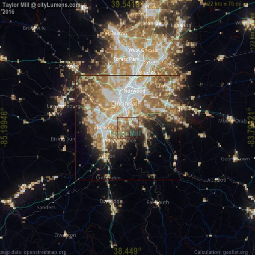
Analysis of Taylor Mill night lights 2016
Square area 10x10 km:
 7.63%
7.63%90-99
10.06%80-89
8.44%70-79
11.04%60-69
15.1%50-59
18.18%40-49
9.74%30-39
7.47%20-29
8.6%10-19
3.73%0-9
0%Square area 50x50 km:
8.57%90-99
9.15%80-89
6.35%70-79
7.69%60-69
8.49%50-59
8.03%40-49
4.09%30-39
3.34%20-29
5.22%10-19
7.26%0-9
31.81%Clear (daylight) street map image can be seen on geolist.org.
Map coordinates:
39° 32' 30.8" North, 85° 11' 58.1" West
38° 59' 51.2" North, 84° 29' 46.8" West
38° 26' 56.4" North, 83° 47' 35.6" West
Some cities around Taylor Mill sort by population:
• Independence
7.3 km =4.5 mi,  214°
214°
• Erlanger
9.3 km =5.8 mi,  283°
283°
• Edgewood
7.8 km =4.8 mi,  287°
287°
• Elsmere
9.5 km =5.9 mi, 280°
• Fort Mitchell
8.2 km =5.1 mi,  327°
327°
• Highland Heights
5.5 km =3.4 mi,  44°
44°
• Cold Spring
5.6 km =3.5 mi,  61°
61°
• Fort Wright
6.9 km =4.3 mi, 331°
4310616 (p: 6,769)
Sources (retrieved 2019-11-25):
» Earth at Night: Flat Maps 2012, 2016