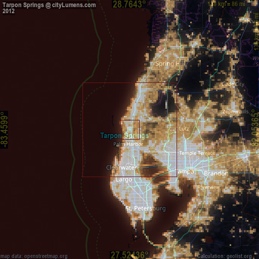
Tarpon Springs night lights from space
Night Light of Tarpon Springs (Florida) from space (United States) Src. Average luminocity for 10x10km area is 70.9716% and for 50x50km: 40.3868%.
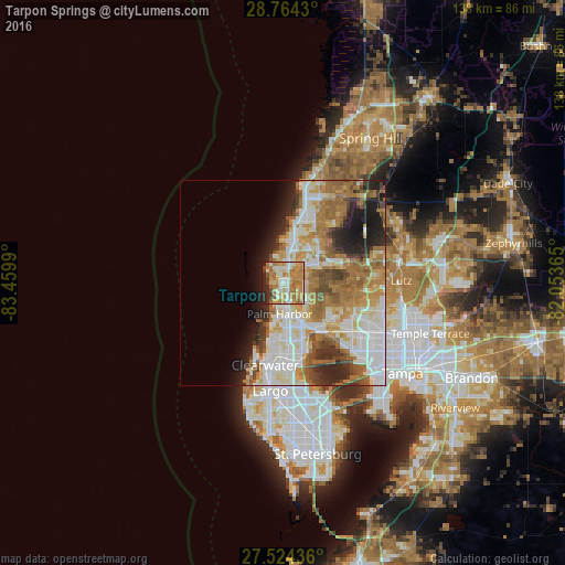
Analysis of Tarpon Springs night lights 2016
Square area 10x10 km:
 10.42%
90-99
13.07%80-89
10.23%70-79
24.62%60-69
21.59%50-59
4.17%40-49
3.41%30-39
2.65%20-29
9.66%10-19
0.19%0-9
0%Square area 50x50 km:
9.27%90-99
8.8%80-89
4.86%70-79
5.78%60-69
9.95%50-59
4.61%40-49
3.6%30-39
2.86%20-29
6.21%10-19
6.42%0-9
37.65%Clear (daylight) street map image can be seen on geolist.org.
Map coordinates:
28° 45' 51.5" North, 83° 27' 35.6" West
28° 8' 46" North, 82° 45' 24.4" West
27° 31' 27.7" North, 82° 3' 13.1" West
Some cities around Tarpon Springs sort by population:
• Palm Harbor
7.6 km =4.7 mi,  185°
185°
• East Lake
7.2 km =4.5 mi,  122°
122°
• Keystone
13.3 km =8.3 mi,  85°
85°
• Holiday
4.9 km =3 mi,  20°
20°
• New Port Richey
11.5 km =7.1 mi, 18°
• Elfers
8.5 km =5.3 mi, 23°
• Trinity
8.3 km =5.2 mi,  62°
62°
• Beacon Square
7 km =4.3 mi,  1°
1°
4174855 (p: 24,605)
Sources (retrieved 2019-11-25):
» Earth at Night: Flat Maps 2012, 2016