Trinity night lights from space
Night Light of Trinity (Florida) from space (United States) Src. Average luminocity for 10x10km area is 74.5139% and for 50x50km: 47.5195%.
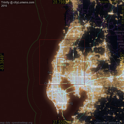
Analysis of Trinity night lights 2016
Square area 10x10 km:
 10.71%
90-99
15.08%80-89
11.51%70-79
22.62%60-69
19.84%50-59
11.51%40-49
8.13%30-39
0.6%20-29
0%10-19
0%0-9
0%Square area 50x50 km:
11.23%90-99
9.53%80-89
5.25%70-79
7.26%60-69
13.42%50-59
5.22%40-49
3.88%30-39
3.11%20-29
5.94%10-19
7.84%0-9
27.32%Clear (daylight) street map image can be seen on geolist.org.
Map coordinates:
28° 47' 55.8" North, 83° 23' 5.6" West
28° 10' 51.1" North, 82° 40' 54.4" West
27° 33' 33.4" North, 81° 58' 43.1" West
Some cities around Trinity sort by population:
• East Lake
7.9 km =4.9 mi,  189°
189°
• Tarpon Springs
8.3 km =5.2 mi,  242°
242°
• Keystone
6.6 km =4.1 mi,  115°
115°
• Holiday
5.7 km =3.5 mi,  277°
277°
• New Port Richey
7.9 km =4.9 mi,  332°
332°
• Elfers
5.6 km =3.5 mi,  315°
315°
• Odessa
8.9 km =5.5 mi,  80°
80°
• Beacon Square
7.8 km =4.8 mi,  293°
293°
4047906 (p: 10,907)
Sources (retrieved 2019-11-25):
» Earth at Night: Flat Maps 2012, 2016