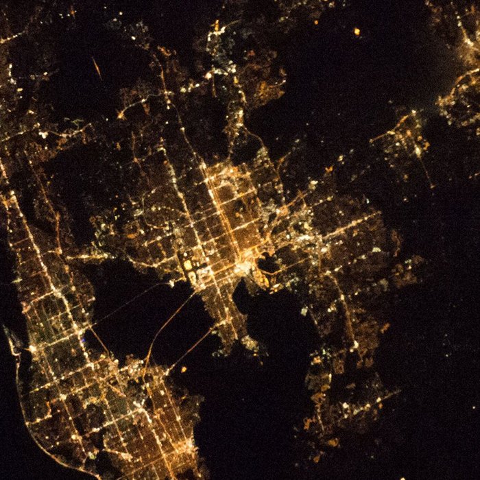
Tampa night lights from space
Night Light of Tampa (Florida) from space (United States) Src. Average luminocity for 10x10km area is 95.0417% and for 50x50km: 66.8159%.
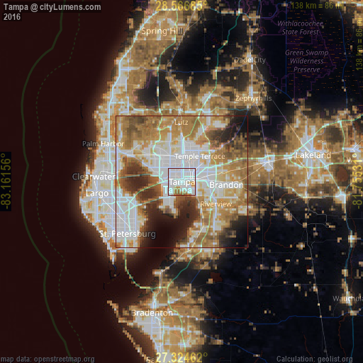
Analysis of Tampa night lights 2016
Square area 10x10 km:
 65.15%
90-99
19.32%80-89
2.84%70-79
4.92%60-69
5.49%50-59
2.27%40-49
0%30-39
0%20-29
0%10-19
0%0-9
0%Square area 50x50 km:
20.04%90-99
14.11%80-89
7.05%70-79
9.07%60-69
15.26%50-59
6.87%40-49
5.47%30-39
4.7%20-29
6.98%10-19
5.51%0-9
4.94%Clear (daylight) street map image can be seen on geolist.org.
Map coordinates:
28° 34' 0.7" North, 83° 9' 41.6" West
27° 56' 51.1" North, 82° 27' 30.3" West
27° 19' 28.6" North, 81° 45' 19.1" West
Fantastic image of Tampa from space taken by astronauts [src2], but I don't have information about it's orientation, scale or angle. If necessary, it was rotated manually, so North points approximately to upper direction. Click to zoom in:
Some cities around Tampa sort by population:
• Town 'n' Country
13.6 km =8.5 mi,  300°
300°
• Egypt Lake-Leto
9.1 km =5.7 mi,  328°
328°
• Carrollwood
11.9 km =7.4 mi,  343°
343°
• Temple Terrace
11.9 km =7.4 mi,  34°
34°
• East Lake-Orient Park
8.7 km =5.4 mi,  63°
63°
• Palm River-Clair Mel
8.2 km =5.1 mi,  108°
108°
• Gibsonton
12.8 km =8 mi,  144°
144°
• Progress Village
10.6 km =6.6 mi,  119°
119°
4174757 (p: 369,075)
Sources (retrieved 2019-11-25):
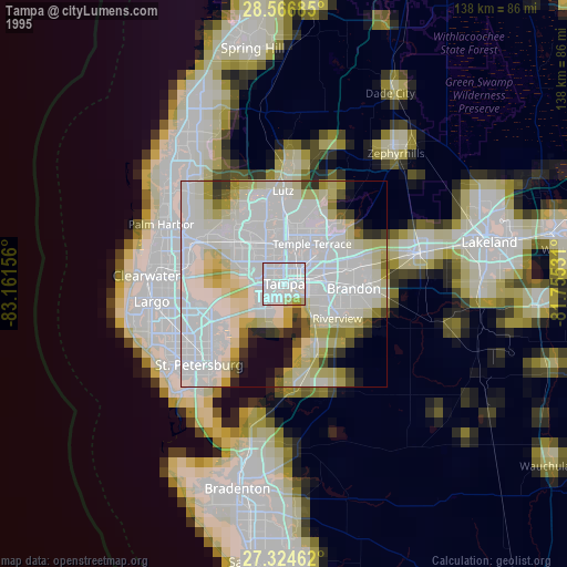
» NASA, Earths city lights 1995
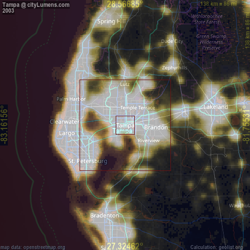
» NASA city lights 2003
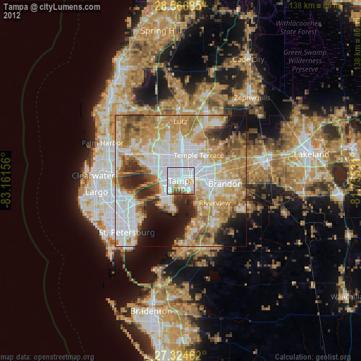
» Earth at Night: Flat Maps 2012, 2016
Src.2: Shane Kimbrough Twitter@astro_kimbroughĀĀ2017-01-12