Gibsonton night lights from space
Night Light of Gibsonton (Florida) from space (United States) Src. Average luminocity for 10x10km area is 61.428% and for 50x50km: 53.4339%.
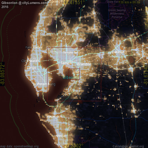
Analysis of Gibsonton night lights 2016
Square area 10x10 km:
 6.82%
6.82%90-99
10.8%80-89
8.14%70-79
15.91%60-69
17.42%50-59
8.14%40-49
4.55%30-39
10.42%20-29
16.67%10-19
1.14%0-9
0%Square area 50x50 km:
14.8%90-99
10.9%80-89
5.62%70-79
5.78%60-69
11.96%50-59
6.55%40-49
5.37%30-39
4.9%20-29
7.6%10-19
9.31%0-9
17.21%Clear (daylight) street map image can be seen on geolist.org.
Map coordinates:
28° 28' 24.6" North, 83° 5' 8.6" West
27° 51' 13.1" North, 82° 22' 57.3" West
27° 13' 48.7" North, 81° 40' 46.1" West
Some cities around Gibsonton sort by population:
• Tampa
12.8 km =8 mi,  324°
324°
• Brandon
13.3 km =8.3 mi,  45°
45°
• Riverview
5.7 km =3.5 mi,  75°
75°
• East Lake-Orient Park
14.4 km =8.9 mi,  1°
1°
• Bloomingdale
14.7 km =9.1 mi,  72°
72°
• Palm River-Clair Mel
7.8 km =4.8 mi, 2°
• Apollo Beach
9.3 km =5.8 mi,  195°
195°
• Progress Village
5.5 km =3.4 mi,  18°
18°
4156748 (p: 14,234)
Sources (retrieved 2019-11-25):
» Earth at Night: Flat Maps 2012, 2016