Sun Lakes night lights from space
Night Light of Sun Lakes (Arizona) from space (United States) Src. Average luminocity for 10x10km area is 42.2028% and for 50x50km: 41.6151%.
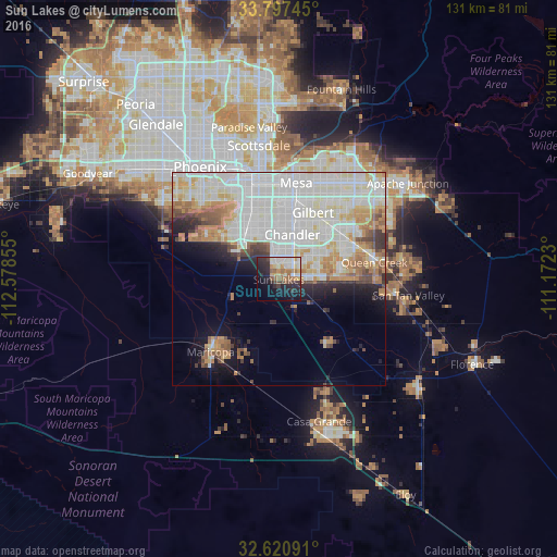
Analysis of Sun Lakes night lights 2016
Square area 10x10 km:
 7.52%
7.52%90-99
9.79%80-89
3.32%70-79
4.2%60-69
9.09%50-59
4.37%40-49
3.67%30-39
5.24%20-29
16.26%10-19
19.41%0-9
17.13%Square area 50x50 km:
13.7%90-99
13.31%80-89
4.12%70-79
4.48%60-69
4.17%50-59
2.83%40-49
2.24%30-39
1.94%20-29
3.19%10-19
6.27%0-9
43.75%Clear (daylight) street map image can be seen on geolist.org.
Map coordinates:
33° 47' 50.8" North, 112° 34' 42.8" West
33° 12' 40.2" North, 111° 52' 31.5" West
32° 37' 15.3" North, 111° 10' 20.3" West
Some cities around Sun Lakes sort by population:
• Chandler
11 km =6.8 mi,  16°
16°
• Gilbert
17.7 km =11 mi,  27°
27°
• Tempe
22.9 km =14.2 mi,  352°
352°
• Tempe Junction
23.4 km =14.5 mi,  344°
344°
• Ahwatukee Foothills
17.7 km =11 mi,  325°
325°
• Maricopa
23.4 km =14.5 mi,  223°
223°
• Queen Creek
22.8 km =14.2 mi,  79°
79°
• Guadalupe
19.5 km =12.1 mi, 335°
5316209 (p: 13,975)
Sources (retrieved 2019-11-25):
» Earth at Night: Flat Maps 2012, 2016