Sturgis night lights from space
Night Light of Sturgis (Michigan) from space (United States) Src. Average luminocity for 10x10km area is 21.6429% and for 50x50km: 4.0545%.
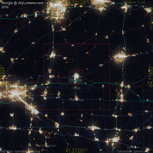
Analysis of Sturgis night lights 2016
Square area 10x10 km:
 3.9%
3.9%90-99
4.06%80-89
3.73%70-79
0.97%60-69
2.44%50-59
3.57%40-49
0.16%30-39
1.95%20-29
0%10-19
22.4%0-9
56.82%Square area 50x50 km:
0.26%90-99
0.43%80-89
0.6%70-79
0.43%60-69
0.71%50-59
0.71%40-49
0.46%30-39
0.78%20-29
0.66%10-19
1.7%0-9
93.26%Clear (daylight) street map image can be seen on geolist.org.
Map coordinates:
42° 19' 16.5" North, 86° 7' 20.2" West
41° 47' 57.2" North, 85° 25' 8.9" West
41° 16' 22.5" North, 84° 42' 57.7" West
Some cities around Sturgis sort by population:
• Elkhart
48.1 km =29.9 mi,  254°
254°
• Portage
46.6 km =29 mi,  343°
343°
• Goshen
42.1 km =26.2 mi,  235°
235°
• Coldwater
38 km =23.6 mi,  65°
65°
• Kendallville
41.8 km =26 mi,  162°
162°
• Angola
39.3 km =24.4 mi,  117°
117°
• Three Rivers
23.9 km =14.9 mi,  312°
312°
• Dunlap
45.4 km =28.2 mi, 246°
5011428 (p: 10,896)
Sources (retrieved 2019-11-25):
» Earth at Night: Flat Maps 2012, 2016