Boardman night lights from space
Night Light of Boardman (Ohio) from space (United States) Src. Average luminocity for 10x10km area is 73.4354% and for 50x50km: 29.2268%.
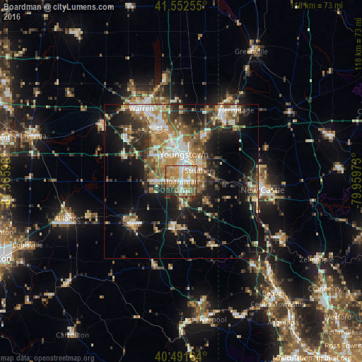
Analysis of Boardman night lights 2016
Square area 10x10 km:
 12.93%
90-99
15.48%80-89
12.07%70-79
15.82%60-69
21.43%50-59
10.37%40-49
3.4%30-39
4.59%20-29
3.91%10-19
0%0-9
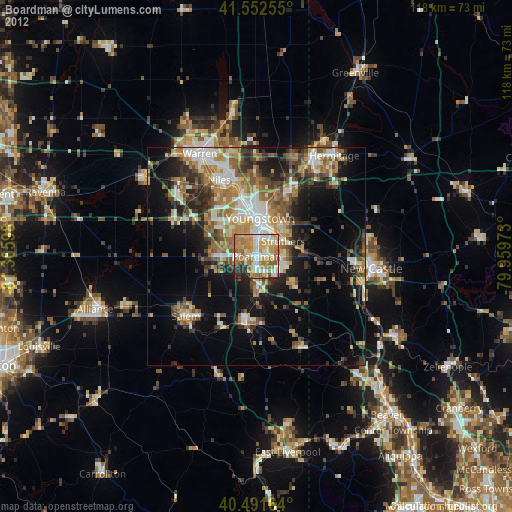
0%Square area 50x50 km:
3.71%90-99
5.13%80-89
3.4%70-79
3.92%60-69
5.18%50-59
4.99%40-49
4.15%30-39
4.59%20-29
8.26%10-19
13.54%0-9
43.13%Clear (daylight) street map image can be seen on geolist.org.
Map coordinates:
41° 33' 9.2" North, 81° 21' 57.5" West
41° 1' 27.2" North, 80° 39' 46.3" West
40° 29' 29.9" North, 79° 57' 35" West
Some cities around Boardman sort by population:
• Youngstown
8.5 km =5.3 mi,  7°
7°
• Austintown
12.1 km =7.5 mi,  315°
315°
• Struthers
5.6 km =3.5 mi,  55°
55°
• Girard
14.8 km =9.2 mi,  347°
347°
• Campbell
8 km =5 mi,  41°
41°
• Hubbard
16.7 km =10.4 mi,  28°
28°
• Canfield
8.2 km =5.1 mi,  270°
270°
• Columbiana
15.3 km =9.5 mi,  189°
189°
5147784 (p: 35,376)
Sources (retrieved 2019-11-25):
» Earth at Night: Flat Maps 2012, 2016