Springs night lights from space
Night Light of Springs (New York) from space (United States) Src. Average luminocity for 10x10km area is 4.3656% and for 50x50km: 2.7798%.
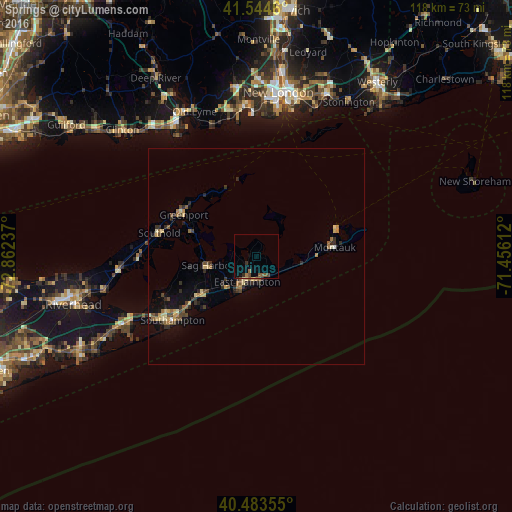
Analysis of Springs night lights 2016
Square area 10x10 km:
 0%
0%90-99
0%80-89
0%70-79
0%60-69
0.85%50-59
2.55%40-49
1.36%30-39
0.68%20-29
0.68%10-19
0.34%0-9
93.54%Square area 50x50 km:
0.03%90-99
0.15%80-89
0.53%70-79
0.37%60-69
0.4%50-59
0.5%40-49
0.59%30-39
0.45%20-29
0.85%10-19
1.19%0-9
94.96%Clear (daylight) street map image can be seen on geolist.org.
Map coordinates:
41° 32' 40.6" North, 72° 51' 44.5" West
41° 0' 58.4" North, 72° 9' 33.3" West
40° 29' 0.8" North, 71° 27' 22" West
Some cities around Springs sort by population:
• New London
38.1 km =23.7 mi,  7°
7°
• Waterford
36.2 km =22.5 mi,  3°
3°
• Hampton Bays
34.3 km =21.3 mi,  241°
241°
• Riverhead
43.6 km =27.1 mi,  255°
255°
• Old Saybrook
35.6 km =22.1 mi,  329°
329°
• Groton
37.7 km =23.4 mi, 10°
• Conning Towers-Nautilus Park
41.8 km =26 mi, 10°
• Southold
23 km =14.3 mi,  283°
283°
5139294 (p: 6,592)
Sources (retrieved 2019-11-25):
» Earth at Night: Flat Maps 2012, 2016