Spartanburg night lights from space
Night Light of Spartanburg (South Carolina) from space (United States) Src. Average luminocity for 10x10km area is 86.8077% and for 50x50km: 32.7254%.
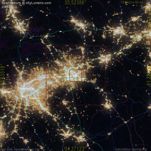
Analysis of Spartanburg night lights 2016
Square area 10x10 km:
 24.54%
90-99
25.27%80-89
18.5%70-79
19.05%60-69
10.81%50-59
1.47%40-49
0.37%30-39
0%20-29
0%10-19
0%0-9
0%Square area 50x50 km:
2.93%90-99
3.23%80-89
5.31%70-79
6.1%60-69
7.26%50-59
5.69%40-49
5.39%30-39
7.24%20-29
7.38%10-19
14.07%0-9
35.4%Clear (daylight) street map image can be seen on geolist.org.
Map coordinates:
35° 31' 25.9" North, 82° 38' 6.6" West
34° 56' 58.5" North, 81° 55' 55.4" West
34° 22' 16.4" North, 81° 13' 44.1" West
Some cities around Spartanburg sort by population:
• Greer
26.9 km =16.7 mi,  267°
267°
• Taylors
33.4 km =20.8 mi,  264°
264°
• Wade Hampton
36.9 km =22.9 mi, 262°
• Five Forks
31.6 km =19.6 mi,  239°
239°
• Gaffney
29.1 km =18.1 mi,  62°
62°
• Fountain Inn
37.7 km =23.4 mi,  219°
219°
• Boiling Springs
11.7 km =7.3 mi,  337°
337°
• Valley Falls
8.3 km =5.2 mi,  332°
332°
4597200 (p: 37,867)
Sources (retrieved 2019-11-25):
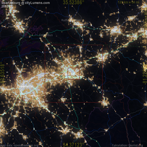
» Earth at Night: Flat Maps 2012, 2016