South Shore night lights from space
Night Light of South Shore (Illinois) from space (United States) Src. Average luminocity for 10x10km area is 84.9659% and for 50x50km: 63.418%.
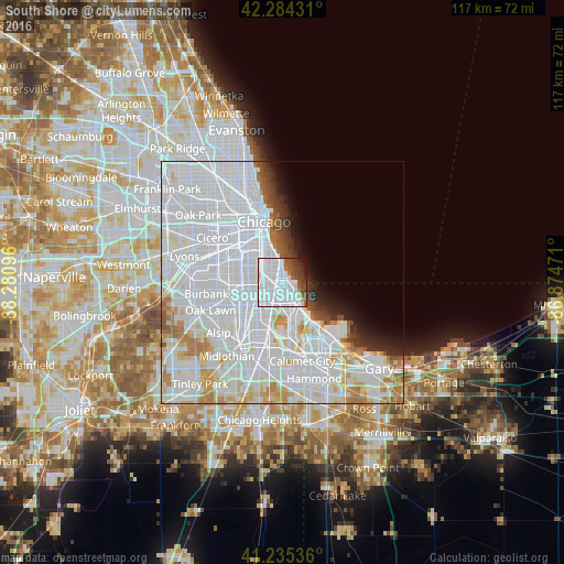
Analysis of South Shore night lights 2016
Square area 10x10 km:
 56.49%
90-99
17.21%80-89
0.65%70-79
0.32%60-69
1.79%50-59
6.17%40-49
7.63%30-39
5.84%20-29
2.27%10-19
1.62%0-9
0%Square area 50x50 km:
38.18%90-99
14.02%80-89
4.39%70-79
3.36%60-69
3.13%50-59
1.59%40-49
1.66%30-39
1.78%20-29
2.08%10-19
2.78%0-9
27.04%Clear (daylight) street map image can be seen on geolist.org.
Map coordinates:
42° 17' 3.5" North, 88° 16' 51.5" West
41° 45' 43.1" North, 87° 34' 40.2" West
41° 14' 7.3" North, 86° 52' 29" West
Some cities around South Shore sort by population:
• Auburn Gresham
6.6 km =4.1 mi,  250°
250°
• Greater Grand Crossing
3.1 km =1.9 mi,  268°
268°
• Chatham
3.7 km =2.3 mi,  231°
231°
• Hyde Park
3.8 km =2.4 mi,  339°
339°
• Englewood
6 km =3.7 mi,  289°
289°
• Woodlawn
2.6 km =1.6 mi,  317°
317°
• Grand Boulevard
6.6 km =4.1 mi,  330°
330°
• Kenwood
5.5 km =3.4 mi, 342°
4912013 (p: 51,451)
Sources (retrieved 2019-11-25):
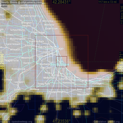
» NASA, Earths city lights 1995
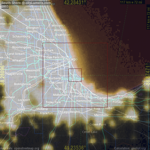
» NASA city lights 2003
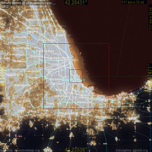
» Earth at Night: Flat Maps 2012, 2016