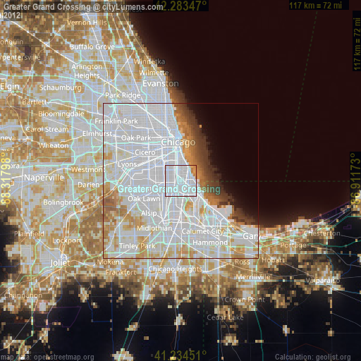
Greater Grand Crossing night lights from space
Night Light of Greater Grand Crossing (Illinois) from space (United States) Src. Average luminocity for 10x10km area is 97.8831% and for 50x50km: 67.7031%.
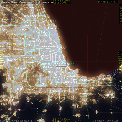
Analysis of Greater Grand Crossing night lights 2016
Square area 10x10 km:
 84.42%
90-99
11.04%80-89
0%70-79
0%60-69
1.46%50-59
2.76%40-49
0.32%30-39
0%20-29
0%10-19
0%0-9
0%Square area 50x50 km:
40.1%90-99
15.16%80-89
5.12%70-79
3.85%60-69
3.23%50-59
1.87%40-49
2%30-39
1.77%20-29
1.85%10-19
2.54%0-9
22.51%Clear (daylight) street map image can be seen on geolist.org.
Map coordinates:
42° 17' 0.5" North, 88° 19' 4.7" West
41° 45' 40.1" North, 87° 36' 53.5" West
41° 14' 4.2" North, 86° 54' 42.2" West
Some cities around Greater Grand Crossing sort by population:
• South Shore
3.1 km =1.9 mi,  88°
88°
• Auburn Gresham
3.8 km =2.4 mi,  235°
235°
• West Englewood
4.7 km =2.9 mi,  293°
293°
• Chatham
2.2 km =1.4 mi,  175°
175°
• Hyde Park
4.1 km =2.5 mi,  25°
25°
• Englewood
3.3 km =2.1 mi,  308°
308°
• Woodlawn
2.4 km =1.5 mi, 31°
• Kenwood
5.5 km =3.4 mi,  15°
15°
8436083 (p: 32,346)
Sources (retrieved 2019-11-25):
» Earth at Night: Flat Maps 2012, 2016