Smyrna night lights from space
Night Light of Smyrna (Delaware) from space (United States) Src. Average luminocity for 10x10km area is 39.3537% and for 50x50km: 11.9682%.
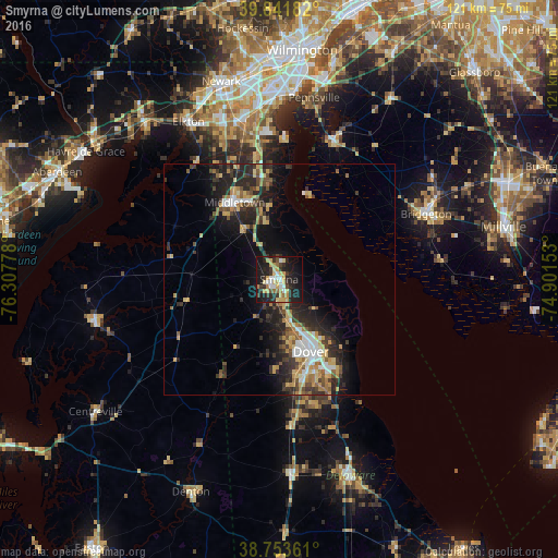
Analysis of Smyrna night lights 2016
Square area 10x10 km:
 5.27%
5.27%90-99
4.25%80-89
10.2%70-79
6.12%60-69
4.93%50-59
1.36%40-49
3.23%30-39
8.84%20-29
14.8%10-19
31.97%0-9
9.01%Square area 50x50 km:
1.48%90-99
1.21%80-89
1.89%70-79
1.83%60-69
1.54%50-59
1.43%40-49
1.68%30-39
2.74%20-29
4.67%10-19
7.6%0-9
73.95%Clear (daylight) street map image can be seen on geolist.org.
Map coordinates:
39° 50' 30.6" North, 76° 18' 28" West
39° 17' 59.4" North, 75° 36' 16.7" West
38° 45' 13" North, 74° 54' 5.5" West
Some cities around Smyrna sort by population:
• Dover
17.2 km =10.7 mi,  156°
156°
• Bridgeton
34.9 km =21.7 mi,  66°
66°
• Middletown
19.2 km =11.9 mi,  330°
330°
• Bear
36.9 km =22.9 mi,  352°
352°
• Elkton
39.4 km =24.5 mi, 330°
• Glasgow
36 km =22.4 mi,  340°
340°
• Pennsville
40 km =24.9 mi,  10°
10°
• New Castle
40.4 km =25.1 mi,  4°
4°
4144764 (p: 11,319)
Sources (retrieved 2019-11-25):
» Earth at Night: Flat Maps 2012, 2016