Pennsville night lights from space
Night Light of Pennsville (New Jersey) from space (United States) Src. Average luminocity for 10x10km area is 47.0519% and for 50x50km: 41.0427%.
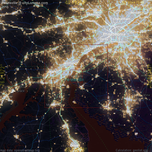
Analysis of Pennsville night lights 2016
Square area 10x10 km:
 7.63%
7.63%90-99
10.39%80-89
5.19%70-79
5.36%60-69
2.92%50-59
7.95%40-49
9.58%30-39
11.53%20-29
11.85%10-19
26.46%0-9
1.14%Square area 50x50 km:
6.68%90-99
7.7%80-89
5.6%70-79
6.67%60-69
7.5%50-59
6.38%40-49
6.01%30-39
6.45%20-29
8.51%10-19
8.96%0-9
29.54%Clear (daylight) street map image can be seen on geolist.org.
Map coordinates:
40° 11' 33.6" North, 76° 13' 11" West
39° 39' 12.4" North, 75° 30' 59.7" West
39° 6' 35.9" North, 74° 48' 48.5" West
Some cities around Pennsville sort by population:
• Wilmington
10.6 km =6.6 mi,  345°
345°
• Bear
12.4 km =7.7 mi,  257°
257°
• Claymont
17.1 km =10.6 mi,  16°
16°
• Wilmington Manor
6.9 km =4.3 mi,  302°
302°
• Carneys Point
7.6 km =4.7 mi,  31°
31°
• Elsmere
11.8 km =7.3 mi,  323°
323°
• Edgemoor
10.8 km =6.7 mi,  7°
7°
• New Castle
4.4 km =2.7 mi,  282°
282°
4503555 (p: 11,888)
Sources (retrieved 2019-11-25):
» Earth at Night: Flat Maps 2012, 2016