Silver City night lights from space
Night Light of Silver City (New Mexico) from space (United States) Src. Average luminocity for 10x10km area is 18.5052% and for 50x50km: 2.3899%.
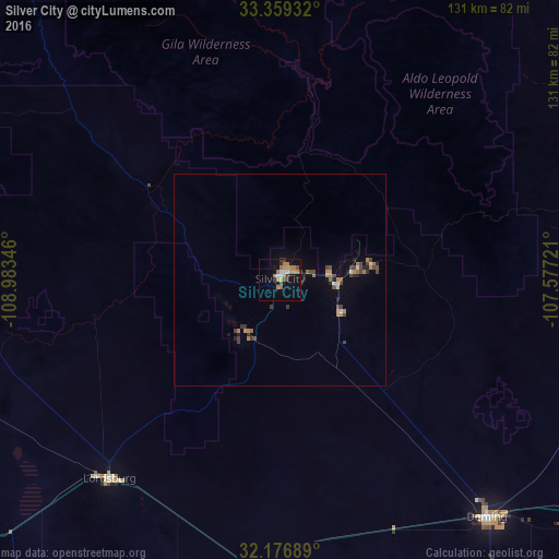
Analysis of Silver City night lights 2016
Square area 10x10 km:
 1.57%
1.57%90-99
1.92%80-89
0.35%70-79
6.29%60-69
4.55%50-59
2.45%40-49
1.4%30-39
2.1%20-29
0.7%10-19
10.84%0-9
67.83%Square area 50x50 km:
0.14%90-99
0.18%80-89
0.01%70-79
0.56%60-69
0.58%50-59
0.19%40-49
0.58%30-39
0.48%20-29
0.38%10-19
0.77%0-9
96.14%Clear (daylight) street map image can be seen on geolist.org.
Map coordinates:
33° 21' 33.6" North, 108° 59' 0.5" West
32° 46' 12.3" North, 108° 16' 49.2" West
32° 10' 36.8" North, 107° 34' 38" West
Some cities around Silver City sort by population:
• Las Cruces
149.7 km =93 mi,  109°
109°
• Deming
74.2 km =46.1 mi,  138°
138°
• Safford
133.6 km =83 mi,  273°
273°
• Anthony
178.8 km =111.1 mi,  118°
118°
• Canutillo
184.4 km =114.6 mi, 121°
• Truth or Consequences
103.8 km =64.5 mi,  67°
67°
• Puerto Palomas, MX
126 km =78.3 mi,  151°
151°
• Anthony
179.1 km =111.3 mi, 118°
5491487 (p: 10,004)
Sources (retrieved 2019-11-25):
» Earth at Night: Flat Maps 2012, 2016