Shelton night lights from space
Night Light of Shelton (Washington) from space (United States) Src. Average luminocity for 10x10km area is 10.8095% and for 50x50km: 4.5598%.
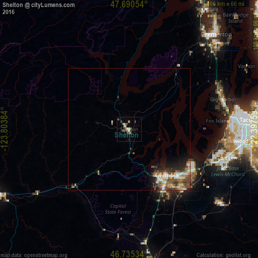
Analysis of Shelton night lights 2016
Square area 10x10 km:
 1.04%
1.04%90-99
1.34%80-89
1.49%70-79
0.3%60-69
1.79%50-59
2.68%40-49
2.38%30-39
1.93%20-29
0.74%10-19
1.34%0-9
84.97%Square area 50x50 km:
0.72%90-99
0.71%80-89
0.37%70-79
0.4%60-69
0.87%50-59
0.88%40-49
1.01%30-39
0.81%20-29
1.05%10-19
1.85%0-9
91.34%Clear (daylight) street map image can be seen on geolist.org.
Map coordinates:
47° 41' 25.9" North, 123° 48' 13.8" West
47° 12' 54.3" North, 123° 6' 2.6" West
46° 44' 7.2" North, 122° 23' 51.3" West
Some cities around Shelton sort by population:
• Olympia
24.8 km =15.4 mi,  142°
142°
• Lacey
29.1 km =18.1 mi,  133°
133°
• Tumwater
27.3 km =17 mi,  147°
147°
• Artondale
37.4 km =23.2 mi,  75°
75°
• DuPont
37.9 km =23.5 mi,  110°
110°
• Steilacoom
38 km =23.6 mi,  97°
97°
• Tanglewilde-Thompson Place
30.3 km =18.8 mi, 126°
• Tanglewilde
30.2 km =18.8 mi, 127°
5810176 (p: 9,834)
Sources (retrieved 2019-11-25):
» Earth at Night: Flat Maps 2012, 2016