Lacey night lights from space
Night Light of Lacey (Washington) from space (United States) Src. Average luminocity for 10x10km area is 57.571% and for 50x50km: 13.0583%.
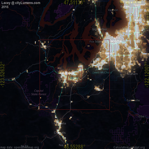
Analysis of Lacey night lights 2016
Square area 10x10 km:
 8.1%
8.1%90-99
9.66%80-89
5.4%70-79
6.68%60-69
13.07%50-59
14.35%40-49
14.2%30-39
11.93%20-29
12.22%10-19
4.4%0-9
0%Square area 50x50 km:
2.33%90-99
2.46%80-89
1.05%70-79
1.34%60-69
2.17%50-59
1.9%40-49
2.02%30-39
1.75%20-29
3.38%10-19
6.83%0-9
74.78%Clear (daylight) street map image can be seen on geolist.org.
Map coordinates:
47° 30' 40.8" North, 123° 31' 34.8" West
47° 2' 3.3" North, 122° 49' 23.5" West
46° 33' 10.4" North, 122° 7' 12.3" West
Some cities around Lacey sort by population:
• Olympia
5.9 km =3.7 mi,  273°
273°
• Tumwater
7.2 km =4.5 mi,  245°
245°
• Joint Base Lewis McChord
20.4 km =12.7 mi,  66°
66°
• DuPont
16.1 km =10 mi,  64°
64°
• Yelm
19.4 km =12.1 mi,  121°
121°
• Steilacoom
22.5 km =14 mi,  47°
47°
• Tanglewilde-Thompson Place
3.7 km =2.3 mi, 59°
• Tanglewilde
3.6 km =2.2 mi, 58°
5800112 (p: 46,409)
Sources (retrieved 2019-11-25):
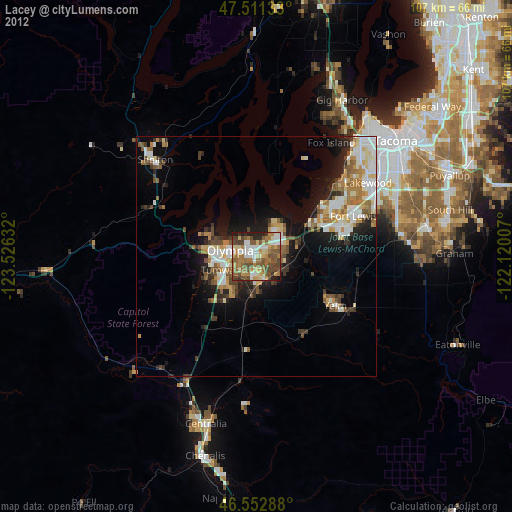
» Earth at Night: Flat Maps 2012, 2016