Kenneth City night lights from space
Night Light of Kenneth City (Florida) from space (United States) Src. Average luminocity for 10x10km area is 96.2557% and for 50x50km: 40.3373%.
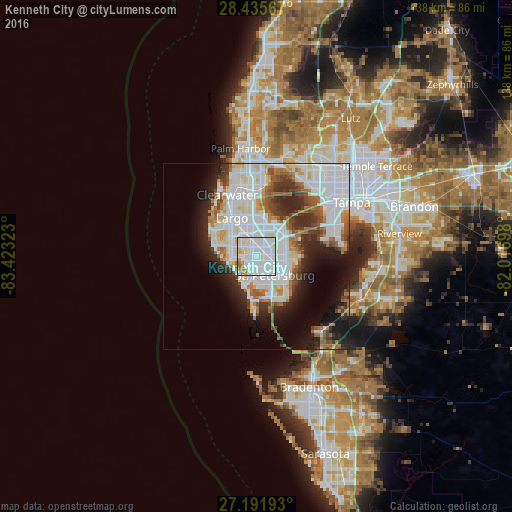
Analysis of Kenneth City night lights 2016
Square area 10x10 km:
 64.02%
90-99
23.11%80-89
4.73%70-79
3.98%60-69
3.41%50-59
0.76%40-49
0%30-39
0%20-29
0%10-19
0%0-9
0%Square area 50x50 km:
16.57%90-99
9.24%80-89
2.84%70-79
2.12%60-69
4.54%50-59
3.16%40-49
3.07%30-39
3.6%20-29
6.92%10-19
9%0-9
38.94%Clear (daylight) street map image can be seen on geolist.org.
Map coordinates:
28° 26' 8.4" North, 83° 25' 23.6" West
27° 48' 56.1" North, 82° 43' 12.4" West
27° 11' 30.9" North, 82° 1' 1.1" West
Some cities around Kenneth City sort by population:
• St. Petersburg
6.4 km =4 mi,  141°
141°
• Pinellas Park
3.6 km =2.2 mi,  33°
33°
• West and East Lealman
3.1 km =1.9 mi,  80°
80°
• Lealman
4.1 km =2.5 mi, 81°
• Seminole
7.5 km =4.7 mi,  291°
291°
• Gulfport
7.7 km =4.8 mi,  167°
167°
• Treasure Island
7.1 km =4.4 mi,  222°
222°
• South Pasadena
6.9 km =4.3 mi,  194°
194°
4160749 (p: 5,072)
Sources (retrieved 2019-11-25):
» Earth at Night: Flat Maps 2012, 2016