Sauk Rapids night lights from space
Night Light of Sauk Rapids (Minnesota) from space (United States) Src. Average luminocity for 10x10km area is 63.2303% and for 50x50km: 7.2288%.
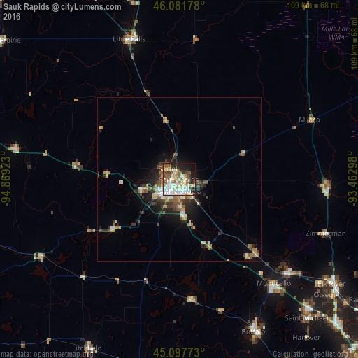
Analysis of Sauk Rapids night lights 2016
Square area 10x10 km:
 17.12%
90-99
18.03%80-89
7.88%70-79
4.39%60-69
6.52%50-59
9.7%40-49
8.03%30-39
3.79%20-29
11.36%10-19
10.76%0-9
2.42%Square area 50x50 km:
1.04%90-99
1.29%80-89
0.63%70-79
0.94%60-69
0.78%50-59
1.2%40-49
1.18%30-39
1.23%20-29
2.01%10-19
3.83%0-9
85.87%Clear (daylight) street map image can be seen on geolist.org.
Map coordinates:
46° 4' 54.4" North, 94° 52' 9.2" West
45° 35' 30.9" North, 94° 9' 58" West
45° 5' 51.8" North, 93° 27' 46.7" West
Some cities around Sauk Rapids sort by population:
• Saint Cloud
3.5 km =2.2 mi,  175°
175°
• Sartell
4.6 km =2.9 mi,  316°
316°
• Monticello
43.1 km =26.8 mi,  137°
137°
• Big Lake
43.6 km =27.1 mi,  131°
131°
• Little Falls
45.4 km =28.2 mi,  340°
340°
• Waite Park
5.9 km =3.7 mi,  229°
229°
• Saint Joseph
12.2 km =7.6 mi,  255°
255°
• Zimmerman
47.8 km =29.7 mi,  110°
110°
5046038 (p: 13,424)
Sources (retrieved 2019-11-25):
» Earth at Night: Flat Maps 2012, 2016